Tarpaulin (stream)
The tarpaulin is a brook near Ibbenbüren in the Westphalian Tecklenburger Land that dried up in 1859 . In earlier years he gave Ibbenbüren the nickname Ibbenbüren on the tarpaulin . It was the only stream that ran south from the Schafberg . All other waters of the Schafberg run north or west. As a result of the mining activity in the region, the river was drained of water and dried up. However, episodically after heavy rains, he finds his way back to life.
course
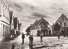
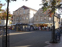
The tarpaulin was a stream system made up of various streams that ran from the Schafberg into the Ibbenbüren valley. The actual tarpaulin didn't begin until the Lower Market in Ibbenbüren. Here, the combined Brunne and Kürtelbecke . However, the well is commonly referred to as a tarpaulin.
Well
The well had its source on the Schafberg, roughly where the intersection of the former federal roads 65 and 219 is today. From there the water-rich mountain stream rushed towards the valley. It flowed down today's steep Osnabrücker Straße towards the city center. Below the Von-der-Heydt-Schacht it took up the Fischbach, a stream that drained from the former mountain ponds, and flowed on to the Welp grinding mill. This was across from today's Leugermann inn. The violence caused by the water becomes clear when you drive through the deep valley that the mountain stream has washed away. This entire valley was only created through the centuries-old power of this stream. Further down the valley it fed the former fire ponds, which were used to drive the Goecke grinding mill in today's Heldermannpark. From today's Heldermannpark the water flowed to the namesake of the well, the Ibbenbüren wash house. This was located on Bahnhofstrasse; At this point there is now a fountain with a stream, which is supposed to remind of the former tarpaulin. The water flowed through Brunnenstrasse to Unterm Markt, where it merged with the water of the Kürtelbecke .
One arm of the well is said to have run down Bahnhofstrasse over the upper market and flowed to the Kürtelbecke in Kanalstrasse. This is said to have fed the moors of the old refuge at the Christ Church. However, the original sketch of the parish archive is lost.
Belt basin
The Kürtelbecke was an open ditch that flowed down the Kanalstrasse. The water had its origin in the area of today's north cemetery.
Plans
From the area of the Lower Market on, the stream was called Plane. It followed the Bachstrasse and flowed into the Aa in the Merschwiesen . However, the underground line for the stream that was laid today runs along Groner Allee to the Aa.
Piping
The remains of the streams were piped around 1900. During the renovation of the inner city in the 1980s, the old piping was replaced by a new watertight one. Since this renewal of the piping, the groundwater level on the Lower Mark has risen to the detriment of the homeowners.
present
On July 29, 2005 the tarpaulin awoke to new life for a few hours when a summer thunderstorm discharged large amounts of water on Ibbenbüren. The Kürtelbecke and the well left their piping, which could not contain the water masses, and flooded the lower market and parts of the further former course.
Individual evidence
- ↑ http://www.stadtmuseum-ibbenbueren.de/stadtgeschichte_aufsaetze18.htm Plane and water supply
- ^ Anton Rosen : Ibbenbüren. Then and now . Ibbenbürener Vereinsdruckerei, Ibbenbüren 1952, p. 71 Ponds are mentioned by name as fire ponds.

