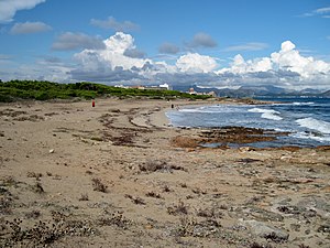
Platja de Na Patana
| Platja de Na Patana | ||
|---|---|---|
| location | Santa Margalida parish | |
| Geographical location | 39 ° 45 '27 " N , 3 ° 10' 30" E | |
|
|
||
| length | 200 m | |
| width | 50 m | |
| nature | sand interspersed with gravel | |
| water | Seagrass deposits possible | |
| Surroundings | natural | |
| tourism | ||
| Visitor frequency | moderate | |
| Parking spaces | no | |
| monitoring | no | |
| Nudism | partially | |
| next hospital | Hospital General de Muro (9 km) | |
| next port | Can Picafort (1.5 km) | |
| Beaches and bays in Mallorca | ||
Platja de Na Patana or Arenal de ses Assussenes is a sandy beach on the north coast of the Spanish Balearic island of Mallorca . It is located in the north of the municipality of Santa Margalida on the Badia d'Alcúdia ("Bay of Alcúdia"), between the towns of Can Picafort and Son Serra de Marina .
Location and description
The beach of Na Patana is about 500 meters southeast of Son Bauló, a district of the town-like settlement of Can Picafort, which is characterized by tourism . It is part of the approximately 1100 hectare nature reserve Dunes de Son Real (type ANEI - Àrea natural d'especial interès).
Together with the beaches of S'Arenal d'en Casat and Platja de Son Real further to the south-east as well as the rocky sections in between, it forms the coastline of the Son Real landscape , a former estate between the torrents Torrent de Son Bauló and Torrent de Son Real . On the coastal plain of the Son Real estate , dunes could form, which are held in place by low vegetation.
At the Platja de Na Patana , the sand forms an approximately 200 meter long and up to 50 meter wide beach area. The beach is bordered by a low rocky coast, which separates it in the northwest by the rocky promontory Na Patana (also Punta de Na Patana ) from the beach of Son Bauló at the mouth of the Torrent de Son Bauló .
In the southeast there is a rocky section that extends to the Punta des Fenicis peninsula , where the Son Real necropolis heralds a bygone culture. The area behind the beach of Na Patana belongs to the Finca pública Son Real , a public estate with extensive pine forests .
Access
The natural coastal hiking trail from Can Picafort to Son Serra de Marina runs over the Platja de Na Patana . The next point that can be reached by vehicle is the district of Can Picafort Son Bauló, which is well developed for tourism and infrastructure. Can Picafort can be reached on the MA-12 road between Artà and Alcúdia . From Son Bauló, Na Patana beach can be reached on foot in around 500 meters.
literature
- Belén Menéndez Solar: Guide de Playas de Mallorca . 1st edition. Ediciones El Cohete, Gijón 2008, ISBN 978-84-87933-11-0 , Na Patana, p. 142 (Spanish).
supporting documents
- Carlos Garrido: Guide of Son Real , Inestur 2009 (Govern de les Illes Balears, Conselleria de Turisme), pp. 113/114
- ↑ Senderisme a Mallorca. Consell de Mallorca, accessed on November 12, 2014 (interactive map).
- ↑ GR 222 - variant D. Hiking trail on the beach. Consell de Mallorca, accessed on May 28, 2015 (PDF file, 2,662.2 KB).
Web links
- Location of the beach
- Beach description (German)
- Map of the Finca pública Son Real with the area Na Patana in the northwest ( Castilian )
- GR 222 - variant D. Hiking trail on the beach. Consell de Mallorca, accessed on May 28, 2015 (PDF file, 2,662.2 KB).


