Playa de Xagó
| Playa de Xagó | ||
|---|---|---|
|
The beach of Xagó, in the background the Península de San Juan |
||
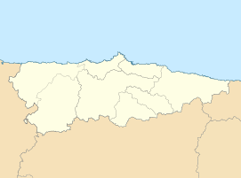
| location | Gozón municipality | |
| Waters | Biscay | |
| Geographical location | 43 ° 39 '2 " N , 5 ° 51' 0" W | |
|
|
||
| length | 2 km | |
| width | 200 m | |
| nature | Sand, dunes | |
| water | Clean, high waves | |
| tourism | ||
| Visitor frequency | moderate, weekend high | |
| Parking spaces | Large parking spaces subject to charge | |
| Nudism | Yes | |
| next port | Avilés industrial port | |
| Others | three restaurants close to the beach | |
The Playa de Xagó ( German: Beach of Xago ) is a beach in the municipality of Gozón , in Asturias in northern Spain , on the Costa Verde on the Bay of Biscay . Due to its long length, the beach is very popular and is highly frequented when the weather is good, especially on weekends, not least because it is the closest beach to the industrial and port city of Avilés , the third largest city in Asturias. The coast in the area of the beach is known for strong waves and currents. Due to the prevailing winds, the marine area is very popular with windsurfers and surfers.
geography
The beach is mainly in the area of the Laviana municipality , only the eastern fifth is in the area of Podes . It consists of a nearly two-kilometer-long sandy beach and a dune area of approximately 350,000 sqm, which for the conservation area of Cabo de Peñas belongs. This makes it one of the larger beaches in Asturias. In the southwest, the beach ends at the cliffs of the Península de San Juan (in German: Peninsula of Saint John or Sant Johannes Peninsula ), in the northeast by the 105 meter high Monte Xagó , which with its steep flank is the backdrop of the beach dominates. The bay in front of the beach is called Ensenada de Xagó (German: Xago Bay ).
The dunes of Xagó
The dunes of Xagó ( Spanish: Dunas de Xagó ) inland cover an area of more than 35 hectares and are considered to be one of the largest contiguous dune areas on the coast in northern Spain, which otherwise consists mainly of rocky cliffs. The dunes are largely covered with Ammophila arenaria , a perennial plant, the 60–120 cm high plant stabilizes the dunes with its rhizomes and thus makes wind erosion more difficult. Further inland, dense blackberry bushes spread across the dunes . In the middle area, the dune belt is bordered by a strip of forest with high trees, mostly eucalyptus. There are three types of dunes: dune ridges with a smooth profile, pyramidal dunes and linear dunes. In the western area, a small beach lake has formed within the dune belt, but it is not suitable for swimming. Entering the dunes is not expressly forbidden and in the immediate vicinity of the beach, the dunes overgrown with knee-high grass are also used as a sunbathing area. The area behind the dune can in fact not be entered due to the thorny vegetation. A paved hiking path runs parallel to the beach and connects the three beach sections west, middle and east.
Tourist importance
Playa de Xagó is of local importance as it is the closest beach to the city of Avilés. In addition, it is also attractive for residents of Gijón who can reach the beach in around 20 minutes and those of the provincial capital Oviedo in around 40 minutes by car. The visitors are therefore mainly Spanish day tourists. For weekend and especially permanent guests from distant parts of Spain and abroad, it is of secondary importance, as there are only a few hostels or no campsites in the immediate vicinity and Asturias also has numerous other seaside resorts with corresponding tourist infrastructure for permanent guests and also more worthwhile excursion destinations in nearby. Parts of the beach are designated as nudist areas. Due to the comparatively milder climate and the higher water temperatures on the Asturian coast, the bathing season is longer than z. B. on the German North Sea coast and goes until about mid-October.
Tourist facilities
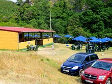
The beach has showers and toilets, three restaurants close to the beach (at the west end, in the middle and in the very east), two large paid parking spaces in the immediate vicinity and a picnic area with grill near the restaurant in the middle. The restaurants are close to the parking lots and mainly offer typical Asturian dishes, but they are only operated during the summer months and are simple in terms of equipment and can be visited with swimwear.
The beach is monitored by Spanish lifeguards (comparable to the DLRG in Germany). In strong winds, only short sections of the sea, marked with flags on the beach line, are open for swimming. This is consistently enforced by the lifeguards. However, since this restriction does not apply to surfers, this always gives rise to discussion.
Web links
- Short film with a flight over the beach and the dunes on Youtube
- Photo series of the beach and dunes
Individual evidence
- ↑ Map with the districts of Gozon ( Memento of the original from December 19, 2013 in the Internet Archive ) Info: The archive link was inserted automatically and has not yet been checked. Please check the original and archive link according to the instructions and then remove this notice.
- ↑ Description on asturnatura.com (Spanish) Retrieved January 12, 2014
- ↑ Map of the coastline around the Playa de Xago
- ↑ Description on VivirAsturias.com ( Memento of the original from January 12, 2014 in the Internet Archive ) Info: The archive link was inserted automatically and has not yet been checked. Please check the original and archive link according to the instructions and then remove this notice. (Spanish) Retrieved January 12, 2014


