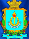
Popivka (Myrhorod)
| Popivka (Myrhorod) | ||
| Попівка | ||

|
|
|
| Basic data | ||
|---|---|---|
| Oblast : | Poltava Oblast | |
| Rajon : | Myrhorod district | |
| Height : | 153 m | |
| Area : | Information is missing | |
| Residents : | 2,306 (2004) | |
| Postcodes : | 37633 | |
| Area code : | +380 5355 | |
| Geographic location : | 50 ° 6 ' N , 33 ° 38' E | |
| KOATUU : | 5323286001 | |
| Administrative structure : | 3 villages | |
| Address: | вул. Леніна 107 37633 с. Попівка |
|
| Website : | http://selomoeridne.at.ua/ | |
| Statistical information | ||
|
|
||
Popiwka ( Ukrainian Попівка ; Russian Поповка Popowka ) is a village in the center of Myrhorod Raion of the Ukrainian Poltava Oblast with 2,300 inhabitants (2004).
The village, founded in the second half of the 16th century, is the administrative center of the district council of the same name , which also includes the villages of Mala Hremjatscha ( Мала Грем'яча ) and Velyka Hremjatscha ( Велика Грем'яча ).
Popivka is located on the bank of the Khorol and its tributary, the 30 km long Khomutez ( Хомутець ) 17 km north of the Rajon center Myrhorod and 120 km northwest of the Oblast center Poltava .
Individual evidence
- ^ Website of the village on the Verkhovna Rada website , (Ukrainian)

