Darwin Harbor
| Darwin Harbor | ||
|---|---|---|
|
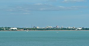
Darwin Harbor from East Point |
||
| Waters | Timor Sea | |
| Land mass | Australia | |
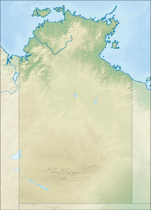
| Geographical location | 12 ° 29 '39 " S , 130 ° 49' 18" E | |
|
|
||
| Tributaries | Blackmore River , Elizabeth River | |
|
Estuary of the Elizabeth River into Darwin Harbor |
||
Darwin Harbor is a ria- like bay near Darwin , the capital of the Australian Northern Territory .
In the west it flows into the Beagle Gulf on the imaginary line from Charles Point in the west to Lee Point in the east . It is connected to the Van Diemen Gulf via this and Clarence Strait .
The bay was named after the naturalist Charles Darwin , who sailed around parts of Australia with Robert Fitzroy on the ship HMS Beagle . However, in 1836 Darwin and Fitzroy sailed from King George Sound ( Western Australia ) directly to the Cocos Islands on the south coast of Java and from there via Cape Town back to England . So they stayed about 3,000 nautical miles from Port Darwin and could not have known of its existence.
Web links
- Map of the catchment area of Darwin Harbor including Shoal Bay (PDF file; 397 kB)
Individual evidence
- ↑ N Smit, R Bill Yard and L Ferns: Beagle Gulf Benthic Survey: Characterization of soft substrates. ( Memento of the original from March 28, 2012 in the Internet Archive ) Info: The archive link was inserted automatically and has not yet been checked. Please check the original and archive link according to the instructions and then remove this notice. (PDF file; 837 kB) Technical Report No. 66 (2000), Parks and Wildlife Commission of the Northern Territory.
- ^ Alan Powell: Who Named Beagle Gulf ?: A Cautionary Tale . Journal of Northern Territory History, No. 22, 2011: 104-108. ISSN 1034-7488 . Accessed October 29, 2012. Pages 2 and 3.


