Porttipahta Reservoir
| Porttipahta Reservoir | |||||||||
|---|---|---|---|---|---|---|---|---|---|
|
|||||||||
|
|
|||||||||
| Coordinates | 67 ° 59 ′ 0 ″ N , 26 ° 41 ′ 0 ″ E | ||||||||
| Data on the structure | |||||||||
| Construction time: | 1970 | ||||||||
| Power plant output: | 35 MW | ||||||||
| Operator: | Kemijoki Oy | ||||||||
| Data on the reservoir | |||||||||
| Altitude (at congestion destination ) | 245 m | ||||||||
| Water surface | 214 km² | ||||||||
| Storage space | 1 203 000 000 m³ | ||||||||
| Catchment area | 2 516 km² | ||||||||
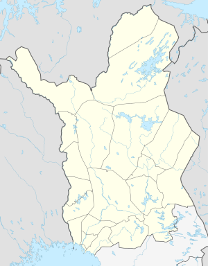
The Porttipahta Reservoir ( ˈpɔrtːipɑhtɑ , finn: Porttipahdan tekojärvi ) is a reservoir in Finnish Lapland . It is located on the upper reaches of the Kitinen River in the municipality of Sodankylä . Depending on the water level, its area is between 34 and 214 km², the level is between 234 and 245 m above sea level .
The Porttipahta reservoir was dammed in 1970 in order to be able to regulate the amount of water from the Kitinen, a tributary of the Kemijoki , for the purposes of hydropower. At the dam there is a hydropower plant with an output of 35 MW and an annual electricity production of 149 GWh (as of 2006). The Porttipahta Reservoir is connected to the Lokka Reservoir to the east by a canal.
Individual evidence
- ↑ JÄRVIWIKI - Porttipahdan tekojärvi (65.831.2.001)

