Presidente Franco
| Presidente Franco | |
|---|---|
|
Coordinates: 25 ° 32 ′ S , 54 ° 37 ′ W
Presidente Franco on the map of Paraguay
|
|
| Basic data | |
| Country | Paraguay |
| Department | Alto Paraná |
| City foundation | October 13, 1929 |
| Residents | 98,800 (2018) |
| - in the metropolitan area | 375,000 |
| City insignia | |
| Detailed data | |
| surface | 12.6 km² |
| Waters | Río Paraná |
| Post Code | 7700 |
| prefix | 061 |
| Time zone | UTC −4 |
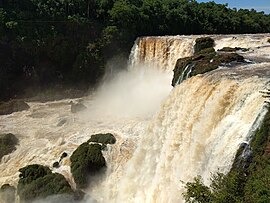
| Saltos del Monday waterfalls | |
Presidente Franco is a port city and district in the Alto Paraná department in Paraguay. The city is located at the confluence of the Río Paraná and Río Monday near the border triangle Argentina - Brazil - Paraguay and has about 99,000 inhabitants. It borders on Ciudad del Este .
history
The city was founded on October 13, 1929 by Vicente Antonio Matiauda, who built a port for the shipment of wood and mate at this point. Residential houses and public facilities were gradually built around the harbor. The place was named after President Manuel Franco (1871-1919), who introduced the civil register and secret elections in Paraguay. In 1979 it was elevated to a first category municipality.
economy
There are several sawmills and food processing factories. Soy is also grown. Tourism is playing an increasing role. The three waterfalls Saltos del Monday, 40 meters high, are a particular attraction for visitors .
Individual evidence
- ↑ Presidente Franco, a 87 años de su fundación y en crecimiento abc.com.py , October 19, 2016, accessed November 18, 2018.
- ↑ La ciudad de Presidente Franco está hoy de fiesta patronal y fundacional ultimahora.com , October 13, 2015, accessed on November 18, 2018.
- ↑ Presidente Franco - Economía altoparana.gov.py , accessed on 18 November 2018th
- ↑ Saltos del Monday bienvenidoaparaguay.com , accessed November 18, 2018.


