Puerto Cisnes
| Cisnes | ||
|---|---|---|
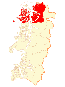
| Location of the municipality in the Aisén region | ||
| Communal data | ||
| region | Aisen | |
| province | Aisen | |
| Residents | 6,517 (2017) | |
| surface | 17,450 km² | |
| Population density | 0.37 inhabitants / km² | |
| Post Code | 6010000 | |
| prefix | + (56-) 67 | |
| Time zone | UTC −4 | |
| Alkalis | Francisco Roncagliolo | |
| Website | ||
| main place | ||
|
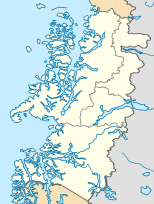
Puerto Cisnes on the map of Chile |
||
| Surname | Puerto Cisnes | |
| status | Pueblo | |
| Residents | 2,558 (2017) | |
| surface | 1.43 km² | |
| Population density | 1,789 inhabitants / km² | |
| Church in Puerto Cisnes | ||
| Puerto Puyuhuapi | ||
Puerto Cisnes is the capital of the municipality of Cisnes in western Patagonia , southern Chile .
The municipality with a total of 6517 inhabitants covers an area of 17,450 km², a substantial part of which consists of islands and the other part of an Andean landscape with high mountains and deep valleys.
The administrative center is Puerto Cisnes at the confluence of the Río Cisnes in the Puyuguapi Canal opposite the Isla Magdalena . With 2558 inhabitants it is the most populous settlement in the municipality, in which there are otherwise only smaller towns such as Puerto Puyuguapi with 535, La Junta with 1431 and Puerto Raúl Marín Balmaceda with 311 inhabitants.
The municipality of Cisnes also includes an uninhabited part of the Chonos Archipelago, including the island of Guamblín in the Pacific Ocean , which is home to a nature reserve that is popular with whale watchers .
Web links
Individual evidence
- ↑ a b Instituto Nacional de Estadisticas - Chile. Resultados censo 2017 ( Accessed June 29, 2019)
- ↑ a b c d Instituto Nacional de Estadisticas - Chile. Ciudades, Pueblos, Aldeas y Caseríos 2019 . ( PDF ; 4.89 MB). (Accessed June 29, 2020)
- ↑ a b Ilustre Municipalidad de Cisnes. Mi Comuna (accessed June 29, 2020)
- ^ Instituto Nacional de Estadisticas - Chile. Ciudades, Pueblos, Aldeas y Caseríos 2005 . ( ZIP ; 11.3 MB) (Retrieved January 2, 2011).


