Quijano (Tamaulipas)
| Quijano | ||
|---|---|---|
|
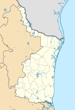
Coordinates: 25 ° 30 ′ N , 97 ° 39 ′ W Quijano on the map of Tamaulipas
|
||
| Basic data | ||
| Country | Mexico | |
| State | Tamaulipas | |
| Municipio | Matamoros | |
| Residents | 103 (2010) | |
| Detailed data | ||
| height | 4 m | |
Quijano is a place in the state of Tamaulipas in Mexico . It belongs to the municipality of Matamoros and has 103 inhabitants (2010).
location
Quijano is four meters above sea level. To the connection road Caretera Federal 101 it is 5 km to the northwest and Valle Hermoso is 25 km away in the same direction as the crow flies. The Gulf of Mexico in the east is 30 km and the US border in the north at Matamoros and Brownsville in Texas is also around 30 km.
Culture
The town's primary school is named after Capitán José Ángel Garza.
