Heroica Matamoros
| Heroica Matamoros | ||
|---|---|---|
|
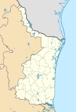
Coordinates: 25 ° 52 ′ N , 97 ° 30 ′ W Heroica Matamoros on the map of Tamaulipas
|
||
| Basic data | ||
| Country | Mexico | |
| State | Tamaulipas | |
| Municipio | Matamoros | |
| Residents | 449,815 (2010) | |
| City insignia | ||
| Detailed data | ||
| height | 9 m | |
| City Presidency | Jesus de la Garza Díaz del Guante | |
| Website | ||
Matamoros , officially Heroica Matamoros , is a city in the north of the Mexican state of Tamaulipas . According to the 2010 census, it had 449,815 inhabitants. The city is on the Rio Grande across from Brownsville , Texas . It is approximately 1,000 kilometers from Mexico City and 571 kilometers from Houston . It was named after Mariano Matamoros . Heroica Matamoros is the administrative seat of the Municipio Matamoros .
history
The first settlers in the region were Indians. In 1519, when Capitán Alonso made an expedition in the region, he baptized the city of Rio de Las Palmas.
In December 2004, snow fell in Matamoros for the first time since 1895.
On November 5, 2010, a leader of the Gulf cartel , Ezequiel Cárdenas Guillén , was shot dead in a six-hour battle with soldiers in Matamoros . During the shooting, the city closed three border crossings with Brownsville, Texas, and four members of the Gulf cartel, four soldiers and a reporter for the local newspaper Express died.
sons and daughters of the town
- Rigo Tovar (1946–2005), singer and composer
- Margarito Salazar Cárdenas (* 1958), Bishop of Matehuala
- Cristina Rivera Garza (* 1964), writer
- Osiel Cárdenas Guillén (* 1967), drug dealer
Individual evidence
- ↑ Catálogo de Localidades: Heroica Matamoros. Retrieved December 10, 2016 .
- ↑ Cecibel Romero: drug lord dies in a hail of bullets. In: the daily newspaper . November 7, 2010, accessed November 9, 2010 .


