Ecological Réserve de Couchepaganiche
|
Ecological Réserve de Couchepaganiche
|
||
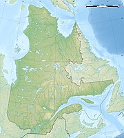
| location | Lac-Saint-Jean-Est , Quebec, Canada | |
| surface | 0.38 km² | |
| WDPA ID | 18148 | |
| Geographical location | 48 ° 22 ′ N , 71 ° 50 ′ W | |
|
|
||
| Setup date | 1983 | |
| administration | MDDEP | |
The Réserve écologique de Couchepaganiche is a protected area established in 1983 on an area of only 37.99 hectares in the southwest of the Canadian province of Québec , in the county of Lac-Saint-Jean-Est .
It belongs to the municipalities of Métabetchouan – Lac-à-la-Croix and Lac-à-la-Croix in the administrative region of Saguenay – Lac-Saint-Jean . It represents and protects the forests typical of the area, in which the yellow birch predominates, at the same time it serves to preserve the rare occurrences of the red oak ( Quercus rubra ), which is referred to here as Chêne rouge d'Amérique .
The reserve is typical of the erosion areas of the Canadian Shield upstream of the Laurentides . The approximately 100 meter high cone has a steep slope with a 30% incline, which points to a plain 257 meters high. The subsoil often consists of granite and pegmatite , on which tillite was deposited during and after the last ice age . Of rock and rock interspersed Podsol circumscribes the bottom of the region, often interspersed with bare rock.
In addition to the yellow birch, there is the American quivering aspen ( Populus tremuloides ), but also the paper birch . These tree communities, including those of the rarer species such as the red oak, are typical of areas affected by forest fires in this region, so they represent a transition phase as soon as the fires stop.
The name of the area goes back to the Couchepaganiche ( Rivière Couchepaganiche ), a 20-kilometer-long stream that flows into Lac Saint-Jean from the southeast.
Web links
- Réserve écologique de Couchepaganiche , government website
