Río Bajoz
| Río Bajoz | ||
|
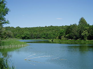
The dammed Río Bajoz |
||
| Data | ||
| location | Castile and León , Spain | |
| River system | Duero | |
| Drain over | Duero → Atlantic | |
| muzzle | in the Duero coordinates: 41 ° 29 ′ 15 ″ N , 5 ° 21 ′ 7 ″ W 41 ° 29 ′ 15 ″ N , 5 ° 21 ′ 7 ″ W
|
|
The Río Bajoz is a river in the middle of Spain and the right tributary of the Duero . It flows through the provinces of Palencia , Valladolid and Zamora in the autonomous community of Castilla y León .
It rises in the foothills of the Cantabrian Coast Mountains between the villages of Castromonte and La Mudarra . Significant tributaries are the Daruela and Retortero streams ( Arroyos ) in the city of Adalia . The Río Bajoz flows through the places San Román de Hornija and Morales de Toro and receives the water of the Hornija before it enters the Duero northwest of the city of Villafranca de Duero about five kilometers before the city of Toro behind the Central hidroeléctrica de San Román en el río Duero flows out.
In its course there is a dam called Santa Espina with a wetland according to the Ramsar Convention near the Cistercian monastery of Santa María de la Espina .
Web links
Individual evidence
