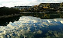
Río Mula
| Río Mula | ||
|
The Salto del Usero waterfall in Bullas |
||
| Data | ||
| location | Murcia Province | |
| River system | Segura River | |
| Drain over | Río Segura → Mediterranean | |
| source | Sierra de Burete y Lavia southwest of Bullas , Murcia | |
| muzzle | at Molina de Segura in the Río Segura coordinates: 38 ° 2 ′ 12 ″ N , 1 ° 13 ′ 26 ″ W 38 ° 2 ′ 12 ″ N , 1 ° 13 ′ 26 ″ W
|
|
| length | approx. 64 km | |
| Catchment area | 659 km² | |
| Drain |
MQ |
5.1 m³ / s |
| Right tributaries | Río Piego | |
| Reservoirs flowed through | Embalse de la Cierva | |
| Small towns | Bullas , Mula | |
The Río Mula is a river in the Murcia region of Spain. It is a right tributary of the Río Segura .
location
The roughly 64 km long river rises southwest of Bullas in the province of Murcia and flows east past Mula to the Río Segura , into which it flows at Molina de Segura in the northwest of the city of Murcia . The Embalse de la Cierva reservoir lies in the course of the river .

