Randijaure
| Randijaure | ||
|---|---|---|

|
||
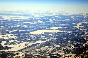
| Aerial view of the Randijaure in winter 2019 | ||
| Geographical location | Norrbotten County , Sweden | |
| Tributaries | Tarraätno | |
| Drain | Tarraätno ( Lilla Luleälven ) | |
| Location close to the shore | Jokkmokk | |
| Data | ||
| Coordinates | 66 ° 43 ′ 0 ″ N , 19 ° 18 ′ 0 ″ E | |
|
|
||
| surface | 50.9 km² | |
| volume | 265 million m³ | |
| Maximum depth | 31 m | |
The Randijaure is a lake in the municipality of Jokkmokk in the Swedish province of Norrbotten County . The lake is part of the Luleälv water system . The largest source river of the Lilla Luleälven , the Tarraätno River, flows through the Randijaure.
The lake is accessed by the Länsväg BD 805. The largest settlement on the lake, the hamlet Randijaur, is located on Länsväg BD 807 . However, this settlement is so small (less than 50 inhabitants) that the SCB does not publish any population figures. The Randijaure is located about twenty kilometers northwest of Jokkmokk .
