Rano Kao
| Rano Kao | ||
|---|---|---|
|
Panorama of the Rano Kao |
||
| height | 320 m | |
| location | Easter Island , Chile | |
| Coordinates | 27 ° 11 ′ 0 ″ S , 109 ° 26 ′ 0 ″ W | |
|
|
||
| Type | extinct shield volcano | |
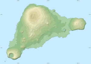
The Rano Kao is an extinct shield volcano up to 320 m high in the southwest of Easter Island , the rock of which has been dated to an age of around 1 million years. The 200 m deep summit crater is a caldera created by the collapse of the volcanic summit . With a diameter of 1.6 km, it is the largest volcanic crater on Easter Island. The rim of the crater has collapsed slightly to the southwest towards the sea. The three motus off the coast - Motu Kaokao, Motu Iti and Motu Nui - are probably the remains of parasitic volcanoes of the Rano Kao.
The freshwater- filled lake inside the crater is half silted up . Just like in the Rano Raraku , the totora reed ( Scirpus californicus ), which is native to the American continent and spread on the island even before human settlement, occurs here. The reeds were used in many ways by the natives of Easter Island, for example for building boats and for covering roofs.
At Rano Kao are the remains of the Orongo cult site with 53 houses and numerous rock carvings of the Vogelmann cult . To the north is the place Hanga Roa with about 3000 inhabitants and the Mataveri International Airport, built in 1960 and expanded by NASA in 1970 .
Individual evidence
- ^ LB Isaacson and DF Heinrichs: Paleomagnetism and Secular Variation of Easter Island Basalts in Journal of Geophysical Research, No. 8, 1976
- ↑ PE Baker et al .: Petrology and Geochemistry of Easter Island in Contributions to Mineralogy and Petrology, No. 2, 1974
Web links
- Easter Island in the Global Volcanism Program of the Smithsonian Institution (English)

