Reeves glacier
| Reeves glacier | ||
|---|---|---|
|
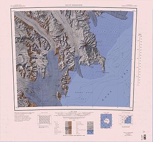
Map sheet with REEVES GLACIER in the southwest area of the map |
||
| location | Victoria Land , East Antarctica | |
| Mountains | Transantarctic Mountains | |
| length | 40 km | |
| surface | 640 km² | |
| Coordinates | 74 ° 45 ′ S , 162 ° 15 ′ E | |
|
|
||
| drainage | Ross Sea | |
The Reeves Glacier is a wide glacier that runs from its area of origin near the polar plateau in East Antarctic Victoria Land to the east between the Eisenhower Range and Mount Larsen and flows into the Ross Sea in conjunction with the Nansen ice sheet .
The glacier was discovered by participants in the Nimrod expedition (1907-1909) led by the British polar explorer Ernest Shackleton . It is named after the New Zealand statesman William Pember Reeves (1857–1932).
See also
Web links
- Reeves Glacier in the Geographic Names Information System of the United States Geological Survey (English)
- Reeves Glacier on geographic.org (English)
- Reeves Glacier. In: Kenneth J. Bertrand and Fred G. Alberts, Geographic names of Antarctica , US Govt. Print. Off., Washington 1956, p. 255 (English)

