Resolution Island (New Zealand)
| Resolution Island (New Zealand) | ||
|---|---|---|
| Waters | Tasman Sea | |
| Geographical location | 45 ° 40 ′ S , 166 ° 40 ′ E | |
|
|
||
| length | 25 km | |
| width | 17.1 km | |
| surface | 208 km² | |
| Highest elevation | Mount Clerke 1069 m |
|
| Residents | uninhabited | |
| Location of Resolution Island | ||
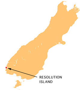
Resolution Island is the largest island in Fiordland in southwest New Zealand . With an area of 208 km², it is the fifth largest island in New Zealand and is uninhabited. Resolution Island is separated from the South Island by Dusky Sound and Breaksea Sound.
The island is roughly rectangular with dimensions of 14 by 17 kilometers, with the exception of a peninsula over 15 kilometers long and a maximum of three kilometers wide on the west coast, the Five Fingers Peninsula .
The island was selected in 2004 as one of the islands designated as a nature reserve on which introduced species are being exterminated in order to protect and reintroduce native bird species.
An attempt to do this was made as early as 1894 when the Department of Lands and Survey made Richard Henry curator of the island, which was then populated with bird species such as kakapo and kiwi , which are threatened by martens on the mainland. This earlier attempt failed when the ermine reached the island in 1900 .
The island is named after James Cook's ship Resolution , which landed on Dusky Sound during Cook's second voyage in March 1773.
literature
- Susanne Hill, John Hill: Richard Henry of Resolution Island. John McIndoe, Dunedin 1987, ISBN 0-86868-094-X .
- Kerry-Jayne Wilson : Flight of the Huia. Canterbury University Press, Christchurch 2004, ISBN 0-908812-52-3 .

