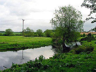
River Pang
| River Pang | ||
|
The River Pang |
||
| Data | ||
| location | Berkshire , England | |
| River system | Thames | |
| Drain over | Thames → North Sea | |
| source | at Compton 51 ° 30 ′ 45 ″ N , 1 ° 14 ′ 24 ″ W. |
|
| muzzle | in Pangbourne in the Thames Coordinates: 51 ° 29 ′ 9 ″ N , 1 ° 5 ′ 16 ″ W 51 ° 29 ′ 9 ″ N , 1 ° 5 ′ 16 ″ W
|
|
| Right tributaries | River Bourne | |
| Communities | Compton , Bradfield , Pangbourne | |
The River Pang is a river in Berkshire , England . The Pang arises near Compton and flows south. It passes under the M4 motorway west of Yattendon . To the west of Bucklebury , the river turns east. He passes Bradfield and again passes under the M4. After crossing under the motorway, it turns north and flows through Pangbourne , where it flows into the Thames in the village west of Whitchurch Bridge and south of Whitchurch Lock .
Web links
Commons : River Pang - collection of images, videos and audio files
