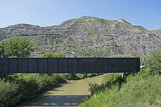
Rosebud River
| Rosebud River | ||
|
Rosebud in Wayne |
||
| Data | ||
| location | Alberta (Canada) | |
| River system | Nelson River | |
| Drain over | Red Deer River → South Saskatchewan River → Saskatchewan River → Nelson River → Hudson Bay | |
| Headwaters | 6 km southwest of Didsbury, central Alberta, 51 ° 37 ′ 51 ″ N , 114 ° 12 ′ 55 ″ W |
|
| Source height | approx. 1050 m | |
| muzzle |
Red Deer River Coordinates: 51 ° 25 ′ 15 " N , 112 ° 37 ′ 43" W 51 ° 25 ′ 15 " N , 112 ° 37 ′ 43" W. |
|
| Mouth height | 675 m | |
| Height difference | approx. 375 m | |
| Bottom slope | approx. 1.7 ‰ | |
| length | approx. 220 km | |
| Catchment area | approx. 4200 km² (effective catchment area: approx. 2900 km²) | |
| Discharge at the Redland A Eo gauge : 3570 km² Location: 50 km above the mouth |
MQ 1970/2016 Mq 1970/2016 |
2 m³ / s 0.6 l / (s km²) |
| Small towns | Didsbury | |
| Communities | Beynon, Redland, Rosebud, Rosedale | |
The Rosebud River is an approximately 220 km long right tributary of the Red Deer River in central Alberta , Canada .
River course
The headwaters of the Rosebud River is 6 km southwest of Didsbury , 60 km north of Calgary . The Rosebud River initially flows 20 km north. Then he turns for the next 90 km in a south-southeast direction. He passes the small town of Didsbury. From Irricana the river flows mainly in an easterly direction. It passes the towns of Beynon , Redland and Rosebud . Finally it flows into the Red Deer River at Rosedale , 10 km southeast of Drumheller . The entire course of the Rosebud River shows a strongly meandering behavior with innumerable narrow river loops and oxbow lakes.
Hydrology
The catchment area of the Rosebud River covers about 4200 km², the effective catchment area about 2900 km². The mean discharge 50 km above the mouth is 2 m³ / s.
