Rutland Water
| Rutland Water | ||
|---|---|---|

|
||
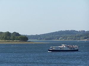
| Rutland Water, passenger ship "Rutland Belle" | ||
| Geographical location | Rutland , England | |
| Tributaries | Gwash | |
| Drain | Gwash → Welland → The Wash | |
| Places on the shore | Empingham , Hambleton , Oakham | |
| Location close to the shore | Peterborough | |
| Data | ||
| Coordinates | 52 ° 39 ′ 36 ″ N , 0 ° 36 ′ 30 ″ W | |
|
|
||
| surface | 12.6 km² | |
Rutland Water is a reservoir in the center of the English Unitary Authority Rutland . With an area of 12.6 km² it is the largest reservoir in England, in terms of water volume it is only surpassed by Kielder Water in Northumberland .

The dam, which the Gwash dammed, was built 1975th During the planning and construction phase, the lake was called Empingham Reservoir . Some places, such as Nether Hambleton and Middle Hambleton, were flooded.
The lake has the shape of a lying U s open to the west and flows around the Hambleton Peninsula, which pushes itself far into the reservoir.
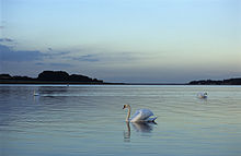
The reservoir is used to supply water to the surrounding villages and towns (especially Peterborough ) and for recreational and leisure purposes. The western part is an important nature reserve that serves as a wintering place for geese and a breeding ground for ospreys .

