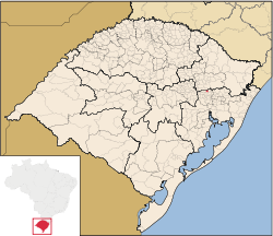
Sao Vendelino
| coat of arms | |
|---|---|

|
|
| State: | Rio Grande do Sul |
| Region: | Caí valley |
| Surface: | 35 km² |
| Residents: | 1,944 |
| Telephone code: | 00 55 51 3639 |
| Mayor: | Evandro Luis Schneider |
| Geographical location: | 29 ° 22 ′ S , 51 ° 22 ′ W |
| Height: | 90–600 m above sea level NN |
| Website: | www.saovendelino.rs.gov.br |
São Vendelino is a city in southern Brazil in the state of Rio Grande do Sul . Around 1,900 people live in an area of 38.75 km². The city is around 90 km from the capital, Porto Alegre , in the Caí Valley region.
São Vendelino has had a town partnership with the Saarland city of St. Wendel since 2003 .
history
After the start of German immigration in southern Brazil in 1824, the land was first given to the "colonists" by the imperial government. In order to speed up the settlement of the country, the government later also sold land to private colonization companies, which in turn sold it on to immigrants.
In 1855, the company Montravel, Silveira & Comp., Founded by the French Compte de Montravel, bought a large area of land on the upper reaches of the Forromeco River in order to set up a private colony. Montravel recruited colonists from Germany, Switzerland, Holland, Belgium and France. According to a publication published in 1924, the first settlers were João Felipe Scheid, Antônio Kossmann, Antônio Ludwig, Nicolau Lermann (probably Lermen) and Nicolau Neis, who came from the Saarland community of Theley in the St. Wendel district . The official name of the colony was Santa Maria de Soledade, the immigrants from the St. Wendel district called their settlement area “St. Wendel” or in the Portuguese version São Vendelino.
After Montravel's company got into economic difficulties in 1873, it was taken over by the Brazilian Empire and in 1883 slammed into the city of Montenegro, 30 km away . In 1953 the residents decided in a referendum that they wanted to belong to the closer city of São Sebastiaõ do Caí . From there in 1982 the Bom Princípio district split off as an independent municipality. On April 29, 1988, the residents of São Vendelino decided that they wanted to become independent, since then São Vendelino has been an independent municipality.
Geographical location and transport links
São Vendelino is located on the Forromeco River in a low mountain range. While the center is 90 m above sea level, the mountains to the west and east of the Forromeco rise to over 600 m. São Vendelino is conveniently located on the RS 122, which from Porto Alegre is almost completely expanded to four lanes.
economy
Originally, São Vendelino was purely agricultural, but numerous industrial companies have emerged over the past 20 years. The most important branch of industry is the shoe industry. a. metal and wood processing companies and a concrete block plant. Agriculture has been heavily industrialized in recent years, with chicken and turkey stalls in the mountains, with more than 30,000 animals raised in individual computer-controlled fattening farms. But there are still farmers who work their fields with the ox team.
Tourism is becoming increasingly important in São Vendelino. So many paraglider pilots come to the city to take off from the Teufelsberg (Morro do Diabo) with their paragliders .
And the city is - similar to the German twin town St. Wendel - a mountain bike stronghold. Every year at the end of April, the Brazilian championships in the downhill category take place here.
Sons and daughters
- Aloísio Roque Oppermann (1936–2014), Catholic clergyman, Archbishop of Uberaba
Photos of São Vendelino
See also
- Riograndenser Hunsrückisch (minority language)
literature
- Association of German Associations (Ed.): One hundred years of being German in Rio Grande do Sul . Typographica do Centro, Porto Algre 1924
- Renato Klein, Alex Steffen: A Construção do Paraís. , Editora Fato Novo, São Sebastião do Caí 2003 (chronicle of local history, published on the occasion of São Vendelino's 15-year independence)
Footnotes
- ↑ Instituto Brasileiro de Geografia e Estatística , results of the 2010 census
Web links
- Site Oficial de São Vendelino (official website, port.)
- Report from a Little Paradise - The Brazilian St Wendel , wcams.com.br


