Sørøya
| Sørøya | ||
|---|---|---|
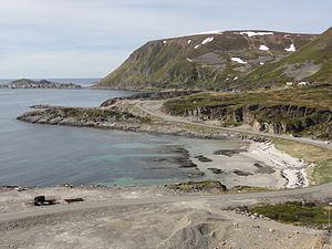
| In the northwest of the island | ||
| Waters | Atlantic Ocean | |
| Geographical location | 70 ° 35 ′ N , 22 ° 44 ′ E | |
|
|
||
| length | 64 km | |
| width | 23 km | |
| surface | 811 km² | |
| Highest elevation | Komagaksla 659 m |
|
| Residents | 1000 (2008) 1.2 inhabitants / km² |
|
| main place | Hasvik | |
| Church in the island's main town Hasvik | ||
Sørøya ( North Sami : Sállan , German : "South Island") is an island in the Norwegian province of Troms og Finnmark , north of the Arctic Circle . With an area of 811.5 square kilometers, it is slightly smaller than Rügen and the fourth largest island in Norway. It is located around 20 kilometers west of Hammerfest and around 16 kilometers from the mainland. It is separated from the island of Seiland by a four-kilometer-wide strait , the Sørøysundet .
The west of the island forms the majority of Hasvik municipality . The east belongs to the Hammerfest municipality. Most of the island's just over 1000 inhabitants live in the Hasvik administrative center and other settlements on the west coast.
Hasvik Airport is located in the southwest of the island . There is a ferry connection to Øksfjord , from where Riksvei 882 leads south to European route 6. The north of the island is only sparsely populated and connected to Hammerfest by a ferry, which also connects the largely pathless settlements.
A counterpart Norðoya there is not nearby. There are just under 80 kilometers northeast of Magerøya only two much smaller side islands called Store Nordøya and Lille Nordøya (German "Big North Island" and "Little North Island").
Individual evidence
- ↑ 100 største øyene i Norge Kartverket, accessed on July 25, 2020 (Norwegian)


