Saarnaki laid
| Saarnaki laid | ||
|---|---|---|
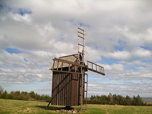
| Windmill from 1880 | ||
| Waters | Baltic Sea | |
| Archipelago | Moonsund Islands | |
| Geographical location | 58 ° 48 '38 " N , 22 ° 59' 37" E | |
|
|
||
| length | 3 km | |
| width | 1 km | |
| surface | 1.36 km² | |
| Residents | uninhabited | |
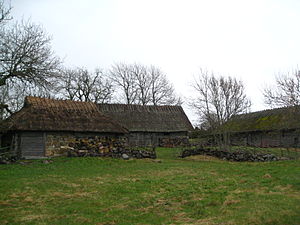
| abandoned farmstead | ||
Saarnaki laid (German: Sarnak ; laid = Estonian for small island ) is an uninhabited island in the Baltic Sea , located in the nature reserve around the Estonian island of Hiiumaa . Like these, it belongs to the Moonsund Islands .
description
The total area of the island is 136 hectares . The island is one of the largest islands in Hiiumaas, 3 km long and 1 km wide. It is between 7 and 9 m above sea level. Administratively it belongs to the Salinõmme village in the Hiiumaa Rural Parish .
Juniper dominates the island .
History and settlement
The island was first mentioned in a document in 1564. At that time people were already living there permanently.
Mainly fishermen lived on the island. Traditionally there were three farms: two in the center of the island and one in the north. It was not until 1924 that new colonists came to Saarnaki laid.
A windmill was built in 1880 and is now a listed building. Some of the vacant houses have been preserved and are of great ethnological value.
Saarnaki laid was inhabited until 1973.


