Sakalua
| Sakalua | ||
|---|---|---|
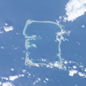
| Satellite image of the Nukufetau Atoll. | ||
| Waters | Pacific Ocean | |
| Archipelago | Nukulaelae | |
| Geographical location | 7 ° 59 ′ S , 178 ° 21 ′ E | |
|
|
||
Sakalua is a reef island in the Nukufetau Atoll in the island state of Tuvalu .
geography
Sakalua lies together with Teafuone in the west of the atoll and relatively far in the interior of the reef. Teafuone is in front of the reef edge. The island is both centrally located in the atoll and between the Teafatule Narrow Deep Pass in the northwest of the atoll and the Teafua Pass (Te Ava Lasi) in the west.
history
In the 19th century whalers founded a camp on Sakalua, where the blubber (whale bacon ) was boiled with coal fires . Because of this, it was also known as Coal Island .
A large colony of terns lives on the island today .
Individual evidence
- ↑ Map of Nukulaelae Atoll. Tuvaluislands.com.
- ^ British Admiralty Nautical Chart 766 Ellice Islands. 21 March 1872, United Kingdom Hydrographic Office (UKHO) 1893.
- ↑ geonames.org .
- ↑ Simati Faanin, Hugh Laracy (ed.): Tuvalu: A History. (Chapter 16 - Travelers and Workers) Institute of Pacific Studies, University of the South Pacific and Government of Tuvalu 1983: 122.

