Samarra weir
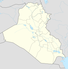
Coordinates: 34 ° 11 ′ 45 ″ N , 43 ° 51 ′ 2 ″ E
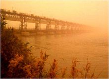
The Samarra weir ( Arabic سد سامراء, DMG Sadd Sāmarrāʾ ) stands on the Tigris west of Samarra in Iraq . It originally served primarily to protect against floods in the areas and places downstream, especially Baghdad , by allowing the flood wave to be conducted over the 75 km long Tharthar Canal into the southern area of Lake Tharthar . It also contains a run-of-river power plant .
The weir itself has almost no storage volume. The Mosul dam , which has now been built around 300 km upstream, has largely lost its importance as flood protection, but is still used to transfer water from the Tigris over Lake Tharthar into the Euphrates .
The structure, which was built from 1953 to 1956 according to the plans of the British engineering office Coode & Partners von Züblin , consists of three parts, a 265 m long straight weir in the Tigris with 17 gates and a fish ladder, the run-of-river power station and the 500-long inlet structure to the canals with 36 Gates.
The much smaller Ishaki River and the Ishaki Canal, called the Haka Canal in its second half, which initially runs parallel to the Tharthar Canal for irrigation purposes, but then over 30 km in a southerly direction, and finally turns west, begin at the weir and flow into the Tharthar Sea Canal.
In April 2015, ISIS took control of the dam.
Individual evidence
- ^ Tabular Summary of Civil Engineering Contract 1953 - Irrigation. ( Memento of the original from March 4, 2016 in the Internet Archive ) Info: The archive link was inserted automatically and has not yet been checked. Please check the original and archive link according to the instructions and then remove this notice. In: The Engineer , January 29, 1954, p. 27 (digital p. 25 of 58) (PDF, 21 MB)
- ↑ The current course of the Ishaki and Ishaki canals is certainly not identical to their course in earlier centuries. See: Carl Ritter: The Geography of Asia, Volume VII, First Section, The stepland of the Euphrates and Tigris systems. Geography in relation to nature and human history ... , Tenth Part, Third Book, G. Reimer, Berlin 1843, p. 221 ( digitized on Google Books - attention: 1180 pages !!)
- ↑ http://www.longwarjournal.org/archives/2015/04/islamic-state-captures-dam-overruns-base-in-western-iraq.php

