San Pablo de las Salinas
| San Pablo de las Salinas | ||
|---|---|---|
|
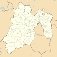
Coordinates: 19 ° 40 ′ N , 99 ° 6 ′ W San Pablo de las Salinas on the map of Mexico
|
||
| Basic data | ||
| Country | Mexico | |
| State | México | |
| Municipio | Tultitlán | |
| Residents | 252,400 (2019) | |
| Detailed data | ||
| surface | 10.7 km² | |
| height | 2250 m | |
San Pablo de las Salinas is the second largest city in the municipality of Tultitlán in the Mexican state of México . It is located in the northeastern part of the state, northeast of the Federal District and in the area of the Zona Metropolitana del Valle de México . With a population of approx. 252,400, San Pablo de las Salinas is the largest town in Mexico that is not a municipality seat.
population
At the 2010 census, the city had a population of 189,453. The literacy (reading ability) was 98.6% of the population. 84.5% of the population were Catholics , 10.1% were Protestants and 5.2% had no religion.
Population development
| year | population |
|---|---|
| 1990 | 84.217 |
| 2000 | 146,560 |
| 2005 | 160,432 |
| 2010 | 189,453 |
| 2015 | 227.200 |
Individual evidence
- ↑ México (Mexico): State & Cities - Population Statistics, Maps, Charts, Weather, and Web Information. Retrieved February 8, 2020 .
