Santikhiri
|
สันติ คีรี Santikhiri |
||
|---|---|---|
|
|
||
| Coordinates | 20 ° 10 ′ N , 99 ° 38 ′ E | |
| Basic data | ||
| Country | Thailand | |
| Chiang Rai | ||
| ISO 3166-2 | TH-57 | |
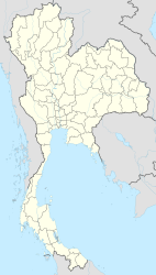
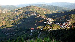
Santikhiri ( Thai : สันติ คีรี earlier: Mae Salong , แม่ ส ลอง ) is a village in the district ( Amphoe ) Mae Fa Luang in the Thai province of Chiang Rai .
geography
Santikhiri is located about 40 km northwest of the provincial capital Chiang Rai and seven kilometers east of the border between Thailand and Myanmar at 1107 meters above sea level . The town is still shaped by Chinese today. Because of its location on the top of the mountain, it is a popular tourist destination. Tea and coffee are grown in the area.
history
It is near the border with Myanmar. Santikhiri was founded in 1961 as Mae Salong, by Kuomintang Chinese of the 93rd regiment under Tuan Shi-Wen on Doi Mae Salong ( ดอย แม่ ส ลอง ), who fled Myanmar .
Until the 1980s, Santikhiri was dominated by opium cultivation. The rebel leader Khun Sa had his headquarters in Ban Hin Taek a few kilometers from Santikhiri until he was driven out by the Thai army in 1982 after three days of fierce fighting.
Web links
- Benjarong Magazine: Mae Salong, China of the North (in English)


