Scarba
| Scarba | |
|---|---|
| Scarba as seen from Luing | |
| Waters | Atlantic Ocean |
| Archipelago | Inner Hebrides |
| Geographical location | 56 ° 10 '35 " N , 5 ° 42' 25" W |
| length | 5 km |
| width | 4 km |
| surface | 14.74 km² |
| Highest elevation | Cruach Scarba 449 m |
| Residents | uninhabited |
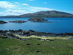
| Grassy landscape on Scarba | |
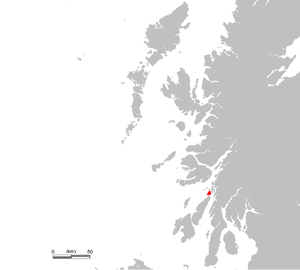
Scarba [ ˈs̪kaɾapə ] is an uninhabited island in the Inner Hebrides . It lies north of the island of Jura and is separated from it by the Strait of Corryvreckan . The barren island extends a maximum of about five kilometers in north-south and about four kilometers in east-west direction. The Cruach Scarba is the highest point on the island with a height of 449 m. It is believed that the islands of Scarba, Jura and Islay were once part of a large peninsula and were separated from the island of Great Britain during the Ice Ages .
The vegetation of Scarba is made up of grass and heather . Red deer , wild goats and otters live on the island . Sheep and cattle also graze there .
Former settlements were mainly on the east coast of the island. Kilmory Lodge , which the island's owner lives in, and a pier in Bagh Gleann a 'Mhaoil Bay are the only permanent structures.
Web links
Individual evidence
- ↑ a b c Entry in the Gazetteer for Scotland
- ^ G. Ritchie (ed.): The Archeology of Argyll , Edinburgh University Press, Edinburgh, 2nd edition, 2002, p. 10. ISBN 0-7486-0645-9


