Schälrück
| Schälrück | ||
|---|---|---|
|
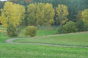
At the sports field of Vitzeroda in the Allmannsloch, behind it the Schälrück rises |
||
| height | 386.1 m above sea level NN | |
| location | Thuringia ( Germany ) | |
| Coordinates | 50 ° 52 '51 " N , 10 ° 4' 52" E | |
|
|
||
| rock | Red sandstone | |
The completely forested mountain Schälrück has a summit height of 386.1 m above sea level. NN and is part of the Frauenseer forest . It is located on the western edge of the district of Springen , near the locality of Vitzeroda , a district of Werra-Suhl-Tal in the Wartburg district in Thuringia .
The Vitzeroda sports field was laid out in the Allmannsloch valley on the western flank of the mountain .
Individual evidence
- ↑ Official topographic maps of Thuringia 1: 10,000. Wartburgkreis, district of Gotha, district-free city of Eisenach . In: Thuringian Land Survey Office (Hrsg.): CD-ROM series Top10 . CD 2. Erfurt 1999.

