Schardara dam
| Schardara dam | |||||||||
|---|---|---|---|---|---|---|---|---|---|
|
|||||||||
|
|
|||||||||
| Coordinates | 41 ° 14 '59 " N , 67 ° 56' 29" E | ||||||||
| Data on the structure | |||||||||
| Construction time: | 1965-1968 | ||||||||
| Power plant output: | 100 MW | ||||||||
| Data on the reservoir | |||||||||
| Altitude (at congestion destination ) | 250 m | ||||||||
| Water surface | 783 km² | ||||||||
| Reservoir length | 80 km | ||||||||
| Reservoir width | 25 km | ||||||||
| Storage space | 5.7 km³ | ||||||||
| The Schardara dam in the center of the picture, southwest of it the Aydarsee | |||||||||
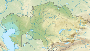
The shardara Dam ( Kazakh Шардара бөгені ) is located in the Kazakh territory Türkistan the Syr Darya .
Part of the southwestern bank belongs to the Uzbek province of Jizzax . The dam was built in 1965–1968 near the city of Schardara . The associated reservoir has an area of 783 km². It measures 80 km × 25 km. The storage volume is 5.7 km³. The hydropower plant has 4 units of 25 MW. The dam is also used to irrigate the surrounding agricultural areas.
Individual evidence
- ↑ Article Schardara Reservoir in the Great Soviet Encyclopedia (BSE) , 3rd edition 1969–1978 (Russian)


