Scree gap
| Scree gap | |||
|---|---|---|---|
| Compass direction | North ( Church Bay ) |
South ( Schlieper Bay ) |
|
| Pass height | 300 m | ||
| location | South Georgia , South Atlantic | ||
| map | |||
|
|
|||
| Coordinates | 54 ° 1 ′ 41 ″ S , 37 ° 48 ′ 21 ″ W | ||
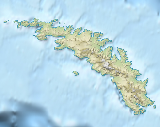
Scree Gap (English for Schutthalde gap is) a mountain pass near the western end of South Georgia . At a height of about 300 m it runs between Church Bay and Schlieper Bay .
The South Georgia Survey mapped it during its 1951-1957 survey campaign. The UK Antarctic Place-Names Committee gave it its descriptive name in 1958.
Web links
- Scree Gap in the Geographic Names Information System of the United States Geological Survey (English)
- Scree Gap on geographic.org (English)
