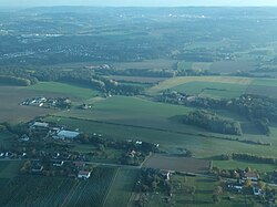
Glider airfield Iserlohn-Rheinermark
| Glider airfield Iserlohn-Rheinermark | |
|---|---|

|
|
| Characteristics | |
| Coordinates | |
| Height above MSL | 191 m (627 ft ) |
| Transport links | |
| Distance from the city center | 10 km north of Iserlohn |
| Basic data | |
| opening | May 1, 1959 |
| operator | LSV Ruhr-Lenne-Iserlohn eV |
| Start-and runway | |
| 07/25 | 800 m × 70 m grass |
The Iserlohn-Rheinermark glider airfield is located in the Rheinermark district of the city of Iserlohn in Sauerland , North Rhine-Westphalia . The operator of the field is the Luftsportvereinigung Ruhr-Lenne Iserlohn .
terrain
The site is located between Iserlohn center and sword , about 10 kilometers south and just outside of the control zone of the Dortmund airport . The airfield is at an altitude of 191 meters above MSL . The length of the unpaved grass runway with the orientation 07/25 is 800 meters.
The place is approved for the operating modes winch launch , aircraft tow , motor glider , UL and balloon .
See also
Web links
Individual evidence
- ↑ a b Airfield data on the website of the LSV Ruhr-Lenne Iserlohn, accessed on November 30, 2010