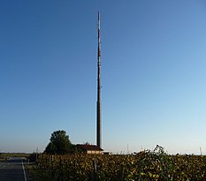
Friedelsheim transmitter
|
Friedelsheim transmitter
|
||
|---|---|---|
| Basic data | ||
| Place: | Friedelsheim | |
| Country: | Rhineland-Palatinate | |
| Country: | Germany | |
| Altitude : | 131 m above sea level NHN | |
| Coordinates: 49 ° 27 ′ 29.8 ″ N , 8 ° 13 ′ 36 ″ E | ||
| Use: | Broadcasting station | |
| Accessibility: | Transmission tower not open to the public | |
| Tower data | ||
| Building materials : | Concrete , reinforced concrete | |
| Data on the transmission system | ||
| Waveband : | FM transmitter | |
| Radio : | VHF broadcasting | |
| Position map | ||
|
|
||
The Friedelsheim transmitter is a transmitter system ( transmitter for short ) for the transmission of radio signals. It is located next to the Bad Dürkheim – Ludwigshafen-Oggersheim railway line in the Friedelsheim district east of Bad Dürkheim . A transmission tower in the form of a free-standing concrete tower is used as the antenna carrier .
From here, parts of the city of Bad Dürkheim are supplied with radio programs.
Frequencies and Programs
Analog radio (VHF)
There are currently the following analogue radio transmitters on the tower:
|
Frequency (MHz) |
program | RDS PS | RDS PI | Regionalization |
ERP (kW) |
Antenna pattern round (ND) / directional (D) |
Polarization horizontal (H) / vertical (V) |
|---|---|---|---|---|---|---|---|
| 96.4 | bigFM | _big_FM_ | D3A9 | Rhineland-Palatinate | 0.1 | D (220-320 °) | H |
| 98.1 | RPR1 |
RPR1._LU _RPR1 .__ |
D8A8 (regional), D3A8 |
Ludwigshafen | 0.05 | D (220–290 °) | H |
Analog television (PAL)
Before the switch to DVB-T, the broadcasting location was still used for analog television.
| channel |
Frequency (MHz) |
program |
ERP (kW) |
Transmission diagram round (ND) / directional (D) |
Polarization horizontal (H) / vertical (V) |
|---|---|---|---|---|---|
| 38 | 607.25 | The First (SWR) | 0.08 | D. | H |
| 55 | 743.25 | SWR television Rhineland-Palatinate | 0.16 | D. | H |


