Shadwan
| Shadwan (Shaker, Shakir) |
||
|---|---|---|
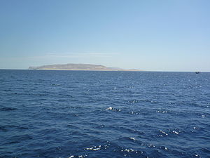
| South side of Shadwan | ||
| Waters | Gulf of Suez | |
| Geographical location | 27 ° 30 ′ N , 33 ° 59 ′ E | |
|
|
||
| length | 14.6 km | |
| width | 4.4 km | |
| surface | 42.49 km² | |
| Highest elevation | 301 m above sea level NN | |
| Residents | uninhabited | |
| Woodcut from 1869 | ||
Shadwan ( Arabic شدوان, DMG Šadwān ) is a barren, rocky island in the mouth of the Gulf of Suez , in the northern Red Sea . It is also known as Shaker Island or Jazirat Shakir . With an area of 42.49 km², it is the largest island in Egypt , disregarding the island of Tiran , which Egypt leases from Saudi Arabia .
location
The island is located about 50 kilometers southwest of the Egyptian city of Sharm el -Sheikh on the Sinai Peninsula and 30 kilometers northeast of the city of el Gouna . It is the largest of a group of islands in the Gubal Strait and is 16 kilometers long and 5 kilometers wide.
geology
When the earthquake on March 31, 1969, the epicenter was near Shadwan. The quake had a magnitude of 6.6. In this area the African and Arabic plates move past each other. The earthquake caused some damage, including numerous rockfalls. The foundation of the Shaker Lighthouse was also damaged. Since the island is not inhabited, there was no personal injury. Some property damage also occurred in Hurghada and Sharm El Sheikh. The quake could also be felt in Cairo . On April 9, 1996, a seismic measuring device was installed on the island. It is part of the seismic network that studies and documents the movements of the earth's crust in this region. The measuring point is self-sufficient and is managed from Hurghada.
history
During the War of Attrition between Israel and Egypt from 1968 to 1970 , the island was fortified and occupied by Egyptian troops. The troop strength was around 100 soldiers. The headquarter was at the lighthouse, other positions were distributed on the island. On January 22, 1970, the island was attacked by Israeli helicopters during Operation Rhodes and occupied for 36 hours. 30 Egyptian soldiers were killed and 62 were taken prisoner. The Israeli army destroyed the existing radar systems and fortifications. Two Egyptian torpedo boats that had left Hurghada were sunk during the battle . There were three dead and six injured in the Israel Defense Forces .
lighthouse
Located on the southern coast of the island, built in 1889, the lighthouse " Shaker Lighthouse ". The approximately 20 meter high tower is made of stone, the lantern is 37 meters high. On both sides of the tower were one-story buildings that were temporarily used by the military and were blown up in the 1970 Israeli attack. The damage caused to the tower by the earthquake and the Israeli attack has not yet been fully repaired.
Diving area
The island is a popular diving area that ships mainly from Hurghada and el Gouna, but also from Sharm el-Sheikh. There are many different dive sites around the island. On the northeast side there is, among other things, a coral wall that drops vertically to about 40 meters. Due to the existing, often weak current from south to north, drift dives are also possible here. Nearby is the Abu Nuhas reef , where several shipwrecks such as the SS Carnatic , the Chrisoula K or the Giannis D can be dived.
Individual evidence
- ^ NN Ambraseys, CP Melville, RD Adams: The Seismicity of Egypt, Arabia and the Red Sea - A Historical Review. Cambridge University Press, 2005, ISBN 0-521-02025-5 .
- ↑ Seismological Observations in and around the Southern Part of the Gulf of Suez, Egypt ( Memento of the original from December 15, 2013 in the Internet Archive ) Info: The archive link was automatically inserted and not yet checked. Please check the original and archive link according to the instructions and then remove this notice.
- ^ S. Aloni, J. Laurier: Israeli A-4 Skyhawk Units in Combat. Combat aircraft. Osprey, Oxford / New York 2009, ISBN 978-1-84603-430-5 .
- ↑ GW Gawrych: The albatross of decisive victory: war and policy between Egypt and Israel in the 1967 and 1973 Arab-Israeli wars. Greenwood Publishing Group, 2000, ISBN 0-313-31302-4 .
- ^ Eugene Register-Guard. Associated Press, Jan 23, 1970, Israeli commandos remove radar from Egyptian isle
- ↑ Operation "Rhodes" (Hebrew) ( Memento of the original from May 18, 2015 in the Internet Archive ) Info: The archive link was inserted automatically and has not yet been checked. Please check the original and archive link according to the instructions and then remove this notice.
- ^ Lighthouses of Egypt: Red Sea
- ↑ Diving at Shadwan - Shaker Island ( Memento of the original from May 1, 2015 in the Internet Archive ) Info: The archive link was inserted automatically and has not yet been checked. Please check the original and archive link according to the instructions and then remove this notice.


