Sherobath
|
Sherobad Sherobod, Шерабад |
||
|
|
||
| Data | ||
| location | Surxondaryo ( Uzbekistan ) | |
| River system | Amu Darya | |
| Drain over | Amu Darya → Aral Sea (temporarily) | |
| source | in Boysuntau 38 ° 15 '36 " N , 67 ° 4' 12" O |
|
| muzzle |
Amu Darya Coordinates: 37 ° 22 '12 " N , 67 ° 0' 0" E 37 ° 22 '12 " N , 67 ° 0' 0" E
|
|
| length | 177 km | |
| Drain at the Sherobad gauge |
MQ |
7.5 m³ / s |
| Medium-sized cities | Sherobod | |
|
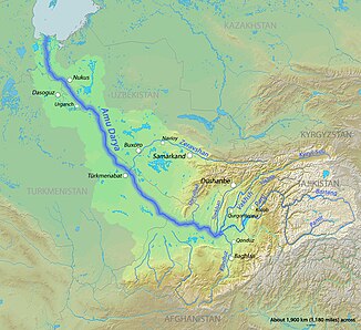
Course of the Sherobad (English Sherabad) in the catchment area of the Amu Darya |
||
The sherabad river ( Uzbek Sherobod, Russian Шерабад , Sherabad ) is a right tributary of the Amu Darya in Uzbekistan Surxondaryo Region .
The Sherobad has its source in the Boysuntau mountain range. It flows south. The European route E60 runs along the river. He finally breaks through a mountain range and reaches the Amu Darya Plain. There it passes the city of Sherobod a little later and reaches the Amu Darya about 30 km west of Termiz . In the lower reaches the river is used for irrigation and only carries very little water.
The Sherobad has a length of 177 km. Its catchment area until it leaves the mountains covers 2950 km². In Sherobad its discharge is 7.5 m / s.
Individual evidence
- ↑ a b c Article Scherabad in the Great Soviet Encyclopedia (BSE) , 3rd edition 1969–1978 (Russian)
