Siechenberg
| Siechenberg | ||
|---|---|---|
|
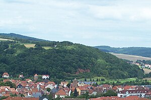
View over Vacha to the Siechenberg. |
||
| height | 366.6 m above sea level HN | |
| location | Hesse and Thuringia ( Germany ) | |
| Coordinates | 50 ° 50 '29 " N , 10 ° 1' 23" E | |
|
|
||
| rock | Red sandstone | |
| particularities | State border, Altstrasse | |
The Siechenberg is an elevation near Philippsthal (Werra) on the Hessian-Thuringian border. The mountain marks a section of the field boundary between the Thuringian city of Vacha , Oberzella district and Philippsthal in the Hersfeld-Rotenburg district in Hesse .
The Siechenberg runs from the Werra valley without a distinctive transition to the "Steinberg" ridge to the north. A topographical point on the south-facing slope is 366.6 m high.
The field name Siechenberg is reminiscent of property that was provided to equip the medieval infirmary at the northern entrance to the Vachaer Werra Bridge . In the Middle Ages, the Hohe Strazza led over the mountain to Berka / Werra and Heringen (Werra) (ravines in the area). On the eastern slope, still on the Hessian side, there is the Thalhausen farm with fields and arable land, which also extend over the southern slope. At the foot of the mountain on the Thuringian side there are some now abandoned quarries that have provided solid building material (gray to red-colored red sandstone) for the bridge, the Vacha city fortifications and some buildings since the Middle Ages.
Individual evidence
- ↑ Official topographic maps of Thuringia 1: 10,000. Wartburgkreis, district of Gotha, district-free city of Eisenach . In: Thuringian Land Survey Office (Hrsg.): CD-ROM series Top10 . CD 2. Erfurt 1999.

