Sierra de las Ánimas
| Sierra de las Ánimas | ||
|---|---|---|
|
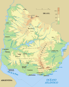
Topographic map of Uruguay |
||
| Highest peak | Cerro de las Ánimas ( 501 m ) | |
| location | Uruguay | |
| part of | Cuchilla Grande | |
|
|
||
| Coordinates | 34 ° 45 ′ S , 55 ° 19 ′ W | |
The Sierra de las Ánimas is a mountain range in Uruguay .
The range of hills was formed several million years ago as the only one of volcanic origin in what is now Uruguay, at a time when the Andes began to unfold. It is located in the west of the Maldonado department near the border with the Canelones department . The Sierra de las Ánimas represents a branch of the Cuchilla Grande and extends, running from north to south, southeast of the city of Minas to the Río de la Plata near Piriápolis . In addition to the two mountains Cerro Betete and Cerro de la Ventana, it is home to the Cerro de las Ánimas (501 meters), the second highest point in the country.

