Minas (Uruguay)
| Minas | ||
|---|---|---|
|
Coordinates: 34 ° 23 ′ S , 55 ° 14 ′ W Minas on the map of Uruguay
|
||
| Basic data | ||
| Country |
|
|
| Department | Lavalleja | |
| Residents | 38,446 (2011) | |
| City insignia | ||
| Detailed data | ||
| height | 140 m | |
| Post Code | 30000 | |
| prefix | +044 | |
| Website | ||
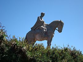
| Artigas statue in Parque Artigas | ||
Minas is the capital of the Lavalleja Department in Uruguay .
geography
Location and landscape
The city is enclosed in a valley, northeast of Montevideo, 122 km away. Nearby is the 305 meter high Cerro Arequita . About 20 km northeast of Minas is the Parque Salto del Penitente . Settlements in the vicinity of Minas are Campanero to the north, Barrio La Coronilla to the southwest, San Francisco de las Sierras to the southeast and the slightly more distant Villa Serrana in the east-northeast and Estación Solís in the west. The Arroyo San Francisco , into which the Arroyo La Plata flows there , runs through the city on the southern or western edge .
Natural resources
Gold deposits exist around five kilometers east of Minas . The Mina Arrospide gold mine is located there .
Residents
The city has 38,446 inhabitants (as of 2011), of which 18,289 are male and 20,157 are female.
| year | Residents |
|---|---|
| 1853 | 1.925 |
| 1963 | 31,805 |
| 1975 | 35,225 |
| 1985 | 34,658 |
| 1996 | 37,146 |
| 2004 | 37,925 |
| 2011 | 38,446 |
Source: Instituto Nacional de Estadística de Uruguay
origin of the name
There are many mines and tunnels in the vicinity of the city, from which the name "Minas" can be traced back.
history
The city was founded in 1783 when 152 settlers from Asturias and Galicia settled here. The city is famous for its cultural heritage.
In 1960 the Diocese of Minas was established. The episcopal church of the diocese is the Catedral de la Inmaculada Concepción , which was inaugurated in 1892.
Infrastructure
traffic
Minas is on Ruta 8 . In addition, a railway line from Montevideo ends in Minas . The AFE currently only operates the route for freight traffic , but the citizens of Minas have already collected signatures for an extension of the passenger traffic , which was discontinued in 1988, from the current terminus Sudriers to Minas.
education
Minas is home to several educational institutions, such as the Liceo Nº 2 Molino Viejo , the Colegio y Liceo San José or the Escuela Nº 102 .
Attractions
In Minas, on Cerro Artigas, there is the world's largest horse statue in memory of General José Gervasio Artigas .
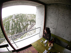
In the vicinity of Minas, 24 kilometers to the east, there is the 60 meter high Salto del Penitente waterfall , a popular excursion destination with tourist infrastructure in the nature park of the same name.
Town twinning
sons and daughters of the town
- Sebastián Abreu (* 1976), football player
- Raúl Ballefín (1923–2013), basketball player, coach and journalist
- Aníbal Barrios Pintos (1918–2011), historian
- Sebastián Britos (* 1988), football player
- Gabriel Cedrés (* 1970), football player
- Horacio Espondaburu (1855–1902), landscape painter
- Germán Ferreira (* 1991), football player
- Santos Inzaurralde (1925–2013), writer and politician
- Baudilio Jáuregui (* 1945), football player and coach
- Álvaro Márquez (* 1990), football player
- Leonardo Pais (* 1994), football player
- Adriana Peña (* 1964), politician
- Alfredo Vidal y Fuentes (1863–1926), politician and physician
- Álvaro Villete (* 1991), football player
Web links
- City map of Minas (PDF; 198 kB)
Individual evidence
- ↑ www.saltodelpenitente.com
- ^ Prof. Ulises Rubens Grub : Atlas geografico de la República Oriental del Uruguay, Montevideo 1980, p. 35
- ↑ Mina de Oro Arrospide (Spanish) ( Memento from January 20, 2013 in the Internet Archive )
- ↑ Statistical data from the Instituto Nacional de Estadística de Uruguay , accessed on September 27, 2012
- ↑ Alfredo Vidal y Fuentes' biography (PDF; 1.4 MB)
- ↑ Statistical data of the Instituto Nacional de Estadística de Uruguay 1963–1996 (DOC; 78 kB)
- ↑ Statistical data of the Instituto Nacional de Estadística de Uruguay (PDF; 628 kB)
- ^ Liceo Nº 2 Molino Viejo


