
Sir Abu Nuʿair
| Sir Abu Nuʿair | ||
|---|---|---|
 |
||
| Waters | Persian Gulf | |
| Geographical location | 25 ° 13 '54 " N , 54 ° 13' 20" E | |
|
||
| length | 4 km | |
| width | 4 km | |
| surface | 14.34 km² | |
| Highest elevation | Green Hill 62 m |
|
| Residents | uninhabited | |
 |
||

Sir Abu Nuʿair ( Arabic أبو صير نعير, DMG Abū Ṣīr Nuʿair ) is an island in the eastern Persian Gulf. It belongs to the Emirate of Sharjah of the United Arab Emirates and forms its westernmost land mass. It is located about 80 km north of Abu Dhabi and about 104 km southwest of Abu Musa . The island with its approximately (except for the southeastern headland) circular ground plan has a diameter of 4 km and is 14.34 km².
Sir Abu Nuʿair is the top end of a salt diapir from the Cambrian . The salt, which occurs frequently in the rock layers of the Strait of Hormuz , made its way through the rocks above and mixed with them. For this reason, evaporites , igneous rock and sandstone containing quartz are typical for the surface of the island.
There are several significant oil fields of Iran and the United Arab Emirates, including Fateh, near the island . The island itself is owned by the oil and gas company Crescent Petroleum .
There is a small port and an airfield on the south-eastern edge of the island. A project with a hotel, 17 private villas, 30 apartments, 16 shops and public facilities (activity center, mosque) was completed there in 2017.
Historical maps

Map by Adolf Stieler (19th century, before the British occupation of the then Iranian island)
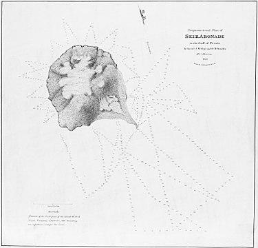
Map from 1825
_and_Abumusa_and_great_and_lesser_Tunbs_are_parts_of_Iranian_territory_in_Iran_and_Turan_Map_by_Adolf_Stieler_map_in_19th_century(before_British_occupation_of_Iranian_islands).jpg)
.jpg)