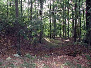
Sirksfelder Schanze
| Sirksfelder Schanze | |
|---|---|
|
Sirksfelde castle wall |
|
| Alternative name (s): | Sirksfelder Schanze, Wallberg |
| Creation time : | 8th to 9th centuries |
| Castle type : | Niederungsburg |
| Conservation status: | Wall and moat remains |
| Place: | Sirksfelde |
| Geographical location | 53 ° 39 '10 " N , 10 ° 30' 39" E |
The Slavic rampart of Sirksfelde , a municipality in the Duchy of Lauenburg in Schleswig-Holstein , is a good kilometer south of the village on the L 200 in the forest.
The approximately 100 meter high castle wall dates from the 8th and 9th centuries and was located in the territory of the Obodrites . As archaeological studies have shown, the Niederungsburg was not in use for long. It may have lost its importance through the course of the Limes Saxoniae around 810. The castle had only one gate that led to the north. Today the ground monument is also known as Wallberg or Sirksfelder Schanze.
literature
- Johannes Hoops: Real Lexicon of Germanic antiquity. Volume 18: Landscape Law - Loxstedt. 2nd completely revised and greatly expanded edition. de Gruyter, Berlin et al. 2001, ISBN 3-11-016950-9 , p. 444.
