
Sirksfelde
| coat of arms | Germany map | |
|---|---|---|

|
Coordinates: 53 ° 40 ′ N , 10 ° 30 ′ E |
|
| Basic data | ||
| State : | Schleswig-Holstein | |
| Circle : | Duchy of Lauenburg | |
| Office : | Secondary sand nuts | |
| Height : | 56 m above sea level NHN | |
| Area : | 8.63 km 2 | |
| Residents: | 338 (Dec. 31, 2019) | |
| Population density : | 39 inhabitants per km 2 | |
| Postal code : | 23898 | |
| Area code : | 04543 | |
| License plate : | RZ | |
| Community key : | 01 0 53 121 | |
| LOCODE : | DE 56E | |
| Office administration address: | Am Amtsgraben 4 23898 Sandesneben |
|
| Website : | ||
| Mayor : | Gerhard Peters | |
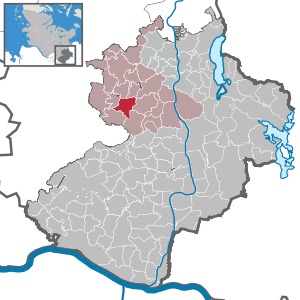
| Location of the municipality of Sirksfelde in the Duchy of Lauenburg | ||
  |
||

Sirksfelde is a municipality in the Duchy of Lauenburg district in Schleswig-Holstein . Kalkkuhle is located in the municipality.
history
The place, already inhabited in pre-Christian times, was first mentioned in 1230 in the Ratzeburg tithe register .
The Wallberg castle , also called Sirksfelder Schanze , is a Slavic ring wall from the 8th / 9th centuries. Century. With a diameter of about one hundred meters, this archaeological monument is located about a kilometer south of the village, to the east of the L 200. Based on archaeological finds, it was found that the border castle was only used for a short time. It is unclear whether the castle lost its importance when the Limes Saxoniae border was established around 810.
Abandoned in the 15th century, the place was repopulated by the Knights of Ritzerowe. In 1747, after being compared with Kurhannover , the Lübeck districts also came to Lauenburg . The community then came to the newly formed Koberg district in 1889 .
politics
Community representation
Of the nine seats in the municipal council, the WGS community of voters has six seats and the ABiS community of voters has three seats.
coat of arms
Blazon : “Divided by green and gold in a rounded beveled cut. Above a flying silver red kite , below a green-silver-green disk, the inner disk above with a green pole reaching into the golden field. "
Web links
Individual evidence
- ↑ North Statistics Office - Population of the municipalities in Schleswig-Holstein 4th quarter 2019 (XLSX file) (update based on the 2011 census) ( help on this ).
- ↑ Schleswig-Holstein topography. Vol. 9: Schönberg - Tielenhemme . 1st edition Flying-Kiwi-Verl. Junge, Flensburg 2007, ISBN 978-3-926055-91-0 , p. 133 ( dnb.de [accessed on August 5, 2020]).
- ↑ Schleswig-Holstein's municipal coat of arms
Albsfelde | Alt-Mölln | Aumühle | Bäk | Blue | Basedow | Basthorst | Behlendorf | Berkenthin | Besenthal | Bliestorf | Exchanges | Borstorf | Breitenfelde | Bröthen | Brunsmark | Brunstorf | Books | Buchholz | Buchhorst | Dahmker | Dalldorf | Dassendorf | Düchelsdorf | Duvensee | Single house | Elmenhorst | Escheburg | Fitzen | Fredeburg | Fuhlenhagen | Geesthacht | Giesensdorf | Göldenitz | Goddess | Grabau | Grambek | Grinau | Big floor | Great Disnack | Groß Grönau | Great Pampau | Great Sarau | Groß Schenkenberg | Grove | Gudow | Gülzow | Bream | Hamfelde | Hamwarde | Harmsdorf | Havekost | Hohenhorn | Hollenbek | Hornbek | Horst | Juliusburg | Kankelau | Kasseburg | Kastorf | Kittlitz | Klein Pampau | Klein reveler | Plumbing | Klinkrade | Koberg | Kollow | Koethel | Kröppelshagen-Fahrendorf | Krukow | Curved mass | Krüzen | Kuddewörde | Killing | Kulpin | Labenz | Langenlehsten | Lankau | Lance | Lauenburg / Elbe | Clay wheel | Linau | Lüchow | Lütau | Mechow | Möhnsen | Mölln | Mill wheel | Must | Mustin | Niendorf ad St. | Niendorf near Berkenthin | Nuts | Panting | Pogeez | Poggensee | Ratzeburg | Ritzerau | Römnitz | Rondeshagen | Roseburg | Sahms | Salem | Sandesneben | Schiphorst | Schmilau | Schnakenbek | Schoenberg | Schretstaken | Schulendorf | Poking soles | Schwarzenbek | Seedorf | Seven trees | Seven oaks | Sierksrade | Sirksfelde | Steinhorst | Sterley | Stump | Talkau | Tramm | Walksfelde | Wangelau | Wentorf (Amt Sandesneben) | Wentorf near Hamburg | Wiershop | Witzeeze | Wohltorf | Woltersdorf | Worth | Ziethen
Community-free area in the Duchy of Lauenburg
Sachsenwald district