
Kröppelshagen-Fahrendorf
| coat of arms | Germany map | |
|---|---|---|

|
Coordinates: 53 ° 29 ′ N , 10 ° 19 ′ E |
|
| Basic data | ||
| State : | Schleswig-Holstein | |
| Circle : | Duchy of Lauenburg | |
| Office : | High Elbgeest | |
| Height : | 57 m above sea level NHN | |
| Area : | 8.37 km 2 | |
| Residents: | 1330 (Dec. 31, 2019) | |
| Population density : | 159 inhabitants per km 2 | |
| Postcodes : | 21529, 21039 | |
| Primaries : | 04104, 04152 | |
| License plate : | RZ | |
| Community key : | 01 0 53 072 | |
| LOCODE : | DE 54G | |
| Office administration address: | Christa-Höppner-Platz 1 21521 Dassendorf |
|
| Website : | ||
| Mayor : | Michael v. Brauchitsch ( CDU ) | |
| Location of the municipality of Kröppelshagen-Fahrendorf in the Duchy of Lauenburg | ||
  |
||

Kröppelshagen-Fahrendorf is a municipality in the Duchy of Lauenburg in Schleswig-Holstein, east of Hamburg .
history
Kröppelshagen first encountered Cropelshaghen in a document dated St. Nicholas Day in 1334. Vorenthorp, on the other hand, was mentioned in a document as early as 1230 in the Ratzeburg tithe register . Temporarily abandoned, it was rebuilt around 1600 about three kilometers southeast of Kröppelshagen. The place name Kröppelshagen-Fahrendorf is not in use until 1900.
In 1945 the community had almost 770 inhabitants, due to the large number of refugees and displaced persons. Much has changed since then. Agriculture decreased steadily, currently there are only six full-time farms. Numerous new residential buildings were built north of today's federal highway 207 . The current population of 1,078 has increased by approx. 14.5 percent since 1991. There is also development potential to the north of federal highway 207, whereby the municipality would like to maintain the village structure.
After the inauguration of the St. Michael Chapel in 1974, the opening of the parish kindergarten in 1996, the over-planning of the town center in 1998 and the construction of the new parish hall in 2002 were important advances for the community. "Everything under one roof" was the motto at the time. Since then, the official youth care, the Kröppelshagener sports club with its 272 members, the volunteer fire brigade , the water supply cooperative and the adult education center are in the house. In 2003, the community-owned library with almost 5000 books, which is managed on a voluntary basis, was added.
politics
Community representation
Since the local elections in 2018, the Voting Community FWK-F has five of the 13 community representative seats , the CDU four, the SPD two seats and the DORF also has two seats.
| CDU | SPD | FWK-F | Village life | Total seats | |
|---|---|---|---|---|---|
| Local election 2013 | 4th | 2 | 3 | 2 | 11 |
| Local election 2018 | 4th | 2 | 5 | 2 | 13 |
coat of arms
Blazon : “Divided by black and gold in a ratio of 3: 5. Above a golden deer pole lying down, below a black sloe branch with green leaves and black fruits. "
photos
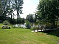
Kröppelshagen

Fahrendorf


Honorary citizen
- Emil Duborg (1878–1972), teacher, Low German author and local historian
Web links
Individual evidence
- ↑ North Statistics Office - Population of the municipalities in Schleswig-Holstein 4th quarter 2019 (XLSX file) (update based on the 2011 census) ( help on this ).
- ^ Office Hohe Elbgeest - local elections. Retrieved February 8, 2019 .
- ^ Announcement of the municipal election results in the municipality of Kröppelshagen-Fahrendorf. May 9, 2018, accessed February 8, 2019 .
- ↑ Schleswig-Holstein's municipal coat of arms
Albsfelde | Alt-Mölln | Aumühle | Bäk | Blue | Basedow | Basthorst | Behlendorf | Berkenthin | Besenthal | Bliestorf | Exchanges | Borstorf | Breitenfelde | Bröthen | Brunsmark | Brunstorf | Books | Buchholz | Buchhorst | Dahmker | Dalldorf | Dassendorf | Düchelsdorf | Duvensee | Single house | Elmenhorst | Escheburg | Fitzen | Fredeburg | Fuhlenhagen | Geesthacht | Giesensdorf | Göldenitz | Goddess | Grabau | Grambek | Grinau | Big floor | Great Disnack | Groß Grönau | Great Pampau | Great Sarau | Groß Schenkenberg | Grove | Gudow | Gülzow | Bream | Hamfelde | Hamwarde | Harmsdorf | Havekost | Hohenhorn | Hollenbek | Hornbek | Horst | Juliusburg | Kankelau | Kasseburg | Kastorf | Kittlitz | Klein Pampau | Klein reveler | Plumbing | Klinkrade | Koberg | Kollow | Koethel | Kröppelshagen-Fahrendorf | Krukow | Curved mass | Krüzen | Kuddewörde | Killing | Kulpin | Labenz | Langenlehsten | Lankau | Lance | Lauenburg / Elbe | Clay wheel | Linau | Lüchow | Lütau | Mechow | Möhnsen | Mölln | Mill wheel | Must | Mustin | Niendorf ad St. | Niendorf near Berkenthin | Nuts | Panting | Pogeez | Poggensee | Ratzeburg | Ritzerau | Römnitz | Rondeshagen | Roseburg | Sahms | Salem | Sandesneben | Schiphorst | Schmilau | Schnakenbek | Schoenberg | Schretstaken | Schulendorf | Poking soles | Schwarzenbek | Seedorf | Seven trees | Seven oaks | Sierksrade | Sirksfelde | Steinhorst | Sterley | Stump | Talkau | Tramm | Walksfelde | Wangelau | Wentorf (Amt Sandesneben) | Wentorf near Hamburg | Wiershop | Witzeeze | Wohltorf | Woltersdorf | Worth | Ziethen
Community-free area in the Duchy of Lauenburg
Sachsenwald district