
Poggensee
| coat of arms | Germany map | |
|---|---|---|

|
Coordinates: 53 ° 38 ' N , 10 ° 35' E |
|
| Basic data | ||
| State : | Schleswig-Holstein | |
| Circle : | Duchy of Lauenburg | |
| Office : | Secondary sand nuts | |
| Height : | 46 m above sea level NHN | |
| Area : | 5.44 km 2 | |
| Residents: | 351 (Dec. 31, 2019) | |
| Population density : | 65 inhabitants per km 2 | |
| Postal code : | 23896 | |
| Area code : | 04543 | |
| License plate : | RZ | |
| Community key : | 01 0 53 099 | |
| LOCODE : | DE 55Y | |
| Office administration address: | Am Amtsgraben 4 23898 Sandesneben |
|
| Website : | ||
| Mayoress : | Anke Brügmann | |
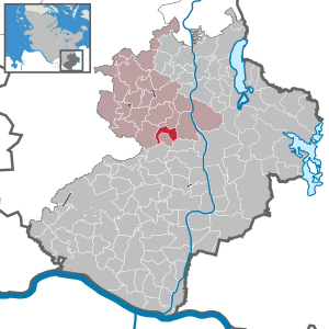
| Location of the municipality of Poggensee in the Duchy of Lauenburg | ||
  |
||

Poggensee is a municipality in the Duchy of Lauenburg in Schleswig-Holstein, east of Hamburg . The name of the village is first passed down as "Pokense", but there are doubts whether it meant ( Low German ) frog ponds , because Wendish traces are also passed down.
history
The community was first mentioned in 1230. In 1747, a settlement in Hanover confirmed the place as Lübeck property. It belonged to the Hanseatic City of Lübeck as an exclave until the Greater Hamburg Act of 1937 and then came to the then Prussian province of Schleswig-Holstein . In 1939 Walksfelde was incorporated, which became independent again in 1951. Since 1948 the community has belonged to the Nusse office , which was added to the Sandesneben-Nusse office in 2008 .
literature
Ingrid Störtenbecker, Tanja Jonas-Störtenbecker: 750 years of Poggensee - a village tells its story (s) , a self-published chronicle
coat of arms
Blazon : "In green a broad golden wavy bar, covered with a left-facing, seated green frog in side view."
Web links
Individual evidence
- ↑ North Statistics Office - Population of the municipalities in Schleswig-Holstein 4th quarter 2019 (XLSX file) (update based on the 2011 census) ( help on this ).
- ↑ Internet of the community
- ↑ Stormarner Tageblatt of December 3, 2014
- ↑ Schleswig-Holstein's coat of arms. Retrieved March 18, 2018 .
Albsfelde | Alt-Mölln | Aumühle | Bäk | Blue | Basedow | Basthorst | Behlendorf | Berkenthin | Besenthal | Bliestorf | Exchanges | Borstorf | Breitenfelde | Bröthen | Brunsmark | Brunstorf | Books | Buchholz | Buchhorst | Dahmker | Dalldorf | Dassendorf | Düchelsdorf | Duvensee | Single house | Elmenhorst | Escheburg | Fitzen | Fredeburg | Fuhlenhagen | Geesthacht | Giesensdorf | Göldenitz | Goddess | Grabau | Grambek | Grinau | Big floor | Great Disnack | Groß Grönau | Great Pampau | Great Sarau | Groß Schenkenberg | Grove | Gudow | Gülzow | Bream | Hamfelde | Hamwarde | Harmsdorf | Havekost | Hohenhorn | Hollenbek | Hornbek | Horst | Juliusburg | Kankelau | Kasseburg | Kastorf | Kittlitz | Klein Pampau | Klein reveler | Plumbing | Klinkrade | Koberg | Kollow | Koethel | Kröppelshagen-Fahrendorf | Krukow | Curved mass | Krüzen | Kuddewörde | Killing | Kulpin | Labenz | Langenlehsten | Lankau | Lance | Lauenburg / Elbe | Clay wheel | Linau | Lüchow | Lütau | Mechow | Möhnsen | Mölln | Mill wheel | Must | Mustin | Niendorf ad St. | Niendorf near Berkenthin | Nuts | Panting | Pogeez | Poggensee | Ratzeburg | Ritzerau | Römnitz | Rondeshagen | Roseburg | Sahms | Salem | Sandesneben | Schiphorst | Schmilau | Schnakenbek | Schoenberg | Schretstaken | Schulendorf | Poking soles | Schwarzenbek | Seedorf | Seven trees | Seven oaks | Sierksrade | Sirksfelde | Steinhorst | Sterley | Stump | Talkau | Tramm | Walksfelde | Wangelau | Wentorf (Amt Sandesneben) | Wentorf near Hamburg | Wiershop | Witzeeze | Wohltorf | Woltersdorf | Worth | Ziethen
Community-free area in the Duchy of Lauenburg
Sachsenwald district