
Kankelau
| coat of arms | Germany map | |
|---|---|---|

|
Coordinates: 53 ° 33 ' N , 10 ° 34' E |
|
| Basic data | ||
| State : | Schleswig-Holstein | |
| Circle : | Duchy of Lauenburg | |
| Office : | Schwarzenbek country | |
| Height : | 38 m above sea level NHN | |
| Area : | 4.21 km 2 | |
| Residents: | 224 (Dec. 31, 2019) | |
| Population density : | 53 inhabitants per km 2 | |
| Postal code : | 21514 | |
| Area code : | 04156 | |
| License plate : | RZ | |
| Community key : | 01 0 53 059 | |
| LOCODE : | DE 56O | |
| Office administration address: | Gülzower Strasse 1 21493 Schwarzenbek |
|
| Website : | ||
| Mayor : | Klaus Hansen (FWK) | |
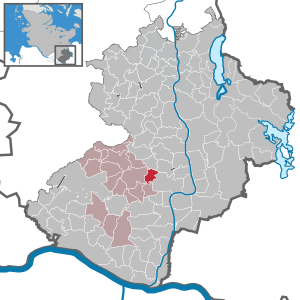
| Location of the municipality of Kankelau in the Duchy of Lauenburg | ||
  |
||

Kankelau is a municipality in the Duchy of Lauenburg in Schleswig-Holstein .
geography
The place is about eight kilometers northeast of Schwarzenbek .
history
Kankelau was first mentioned in the Ratzeburg tithe register as Cankelowe in 1230 . The arrangement of the farms as Rundling to the called Brink village square and the name of the village allow the conclusion to a planned settlement predominantly Slavic farmers during the high medieval eastward expansion to. Since 1948 the community has belonged to the Schwarzenbek-Land office.
politics
Community representation
Of the nine seats in the municipal council, the FWK community of voters has six seats since the 2008 local elections and the WWK community of voters three.
coat of arms
Blazon : “Divided diagonally on the left by green and gold in a rounded beveled step cut. Above a three-fold ring, below a red five-leaf corn wheel with five green leaves. "
Attractions
In the list of cultural monuments in Kankelau are the cultural monuments entered in the monuments list of the state of Schleswig-Holstein.
Web links
Individual evidence
- ↑ North Statistics Office - Population of the municipalities in Schleswig-Holstein 4th quarter 2019 (XLSX file) (update based on the 2011 census) ( help on this ).
- ↑ Schleswig-Holstein's municipal coat of arms
Albsfelde | Alt-Mölln | Aumühle | Bäk | Blue | Basedow | Basthorst | Behlendorf | Berkenthin | Besenthal | Bliestorf | Exchanges | Borstorf | Breitenfelde | Bröthen | Brunsmark | Brunstorf | Books | Buchholz | Buchhorst | Dahmker | Dalldorf | Dassendorf | Düchelsdorf | Duvensee | Single house | Elmenhorst | Escheburg | Fitzen | Fredeburg | Fuhlenhagen | Geesthacht | Giesensdorf | Göldenitz | Goddess | Grabau | Grambek | Grinau | Big floor | Great Disnack | Groß Grönau | Great Pampau | Great Sarau | Groß Schenkenberg | Grove | Gudow | Gülzow | Bream | Hamfelde | Hamwarde | Harmsdorf | Havekost | Hohenhorn | Hollenbek | Hornbek | Horst | Juliusburg | Kankelau | Kasseburg | Kastorf | Kittlitz | Klein Pampau | Klein reveler | Plumbing | Klinkrade | Koberg | Kollow | Koethel | Kröppelshagen-Fahrendorf | Krukow | Curved mass | Krüzen | Kuddewörde | Killing | Kulpin | Labenz | Langenlehsten | Lankau | Lance | Lauenburg / Elbe | Clay wheel | Linau | Lüchow | Lütau | Mechow | Möhnsen | Mölln | Mill wheel | Must | Mustin | Niendorf ad St. | Niendorf near Berkenthin | Nuts | Panting | Pogeez | Poggensee | Ratzeburg | Ritzerau | Römnitz | Rondeshagen | Roseburg | Sahms | Salem | Sandesneben | Schiphorst | Schmilau | Schnakenbek | Schoenberg | Schretstaken | Schulendorf | Poking soles | Schwarzenbek | Seedorf | Seven trees | Seven oaks | Sierksrade | Sirksfelde | Steinhorst | Sterley | Stump | Talkau | Tramm | Walksfelde | Wangelau | Wentorf (Amt Sandesneben) | Wentorf near Hamburg | Wiershop | Witzeeze | Wohltorf | Woltersdorf | Worth | Ziethen
Community-free area in the Duchy of Lauenburg
Sachsenwald district