
Walksfelde
| coat of arms | Germany map | |
|---|---|---|

|
Coordinates: 53 ° 38 ' N , 10 ° 34' E |
|
| Basic data | ||
| State : | Schleswig-Holstein | |
| Circle : | Duchy of Lauenburg | |
| Office : | Secondary sand nuts | |
| Height : | 44 m above sea level NHN | |
| Area : | 3.51 km 2 | |
| Residents: | 235 (Dec. 31, 2019) | |
| Population density : | 67 inhabitants per km 2 | |
| Postal code : | 23896 | |
| Area code : | 04543 | |
| License plate : | RZ | |
| Community key : | 01 0 53 127 | |
| LOCODE : | DE 56H | |
| Office administration address: | Am Amtsgraben 4 23898 Sandesneben |
|
| Website : | ||
| Mayor : | Doreen Keding (BTW) | |
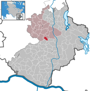
| Location of the municipality of Walksfelde in the Duchy of Lauenburg | ||
  |
||

Walksfelde is a municipality in the Duchy of Lauenburg district in Schleswig-Holstein .
history
Walksfelde was first mentioned as Walegotsa in a document in 1158, when it was received by Bishop Evermod von Ratzeburg as part of the basic equipment of the episcopal table goods . Therefore, Walksfelde later came to Mecklenburg-Strelitz as part of the Principality of Ratzeburg . It belonged to Mecklenburg until the Greater Hamburg Act of 1937 and came to the Duchy of Lauenburg district the following year. In 1939 Walksfelde was incorporated into the neighboring municipality of Poggensee . In 1951, the again independent municipality came to the office of Nusse , which was added to the office of Sandesneben-Nusse in 2008.
politics
Community representation
Of the nine seats in the municipal council, the BTW voter community won all seats in the 2018 local elections.
coat of arms
Blazon : “Divided by gold and red obliquely to the left. Above the black Mecklenburg bull's head, below a standing, naturally tinged, black armored stork. "
Web links
Individual evidence
- ↑ North Statistics Office - Population of the municipalities in Schleswig-Holstein 4th quarter 2019 (XLSX file) (update based on the 2011 census) ( help on this ).
- ↑ Schleswig-Holstein's municipal coat of arms
Albsfelde | Alt-Mölln | Aumühle | Bäk | Blue | Basedow | Basthorst | Behlendorf | Berkenthin | Besenthal | Bliestorf | Exchanges | Borstorf | Breitenfelde | Bröthen | Brunsmark | Brunstorf | Books | Buchholz | Buchhorst | Dahmker | Dalldorf | Dassendorf | Düchelsdorf | Duvensee | Single house | Elmenhorst | Escheburg | Fitzen | Fredeburg | Fuhlenhagen | Geesthacht | Giesensdorf | Göldenitz | Goddess | Grabau | Grambek | Grinau | Big floor | Great Disnack | Groß Grönau | Great Pampau | Great Sarau | Groß Schenkenberg | Grove | Gudow | Gülzow | Bream | Hamfelde | Hamwarde | Harmsdorf | Havekost | Hohenhorn | Hollenbek | Hornbek | Horst | Juliusburg | Kankelau | Kasseburg | Kastorf | Kittlitz | Klein Pampau | Klein reveler | Plumbing | Klinkrade | Koberg | Kollow | Koethel | Kröppelshagen-Fahrendorf | Krukow | Curved mass | Krüzen | Kuddewörde | Killing | Kulpin | Labenz | Langenlehsten | Lankau | Lance | Lauenburg / Elbe | Clay wheel | Linau | Lüchow | Lütau | Mechow | Möhnsen | Mölln | Mill wheel | Must | Mustin | Niendorf ad St. | Niendorf near Berkenthin | Nuts | Panting | Pogeez | Poggensee | Ratzeburg | Ritzerau | Römnitz | Rondeshagen | Roseburg | Sahms | Salem | Sandesneben | Schiphorst | Schmilau | Schnakenbek | Schoenberg | Schretstaken | Schulendorf | Poking soles | Schwarzenbek | Seedorf | Seven trees | Seven oaks | Sierksrade | Sirksfelde | Steinhorst | Sterley | Stump | Talkau | Tramm | Walksfelde | Wangelau | Wentorf (Amt Sandesneben) | Wentorf near Hamburg | Wiershop | Witzeeze | Wohltorf | Woltersdorf | Worth | Ziethen
Community-free area in the Duchy of Lauenburg
Sachsenwald district