
Kulpin
| coat of arms | Germany map | |
|---|---|---|

|
Coordinates: 53 ° 43 ' N , 10 ° 42' E |
|
| Basic data | ||
| State : | Schleswig-Holstein | |
| Circle : | Duchy of Lauenburg | |
| Office : | Lauenburg lakes | |
| Height : | 41 m above sea level NHN | |
| Area : | 6.07 km 2 | |
| Residents: | 201 (Dec. 31, 2019) | |
| Population density : | 33 inhabitants per km 2 | |
| Postal code : | 23911 | |
| Area code : | 04541 | |
| License plate : | RZ | |
| Community key : | 01 0 53 078 | |
| LOCODE : | DE 54U | |
| Office administration address: | Fünfhausen 1 23909 Ratzeburg |
|
| Website : | ||
| Mayor : | Heinz Dohrendorff (AWG) | |
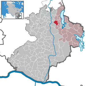
| Location of the municipality of Kulpin in the Duchy of Lauenburg | ||
  |
||

Kulpin is a municipality in the Duchy of Lauenburg in Schleswig-Holstein, east of Hamburg .
history
Kulpin was first mentioned in a document in 1228 and is a Slavic foundation. In the Middle Ages, Kulpin was the seat of a castle belonging to the Lauenburg noble family von Culpyn / Kulpin, where the Kulpin estate can now be found. It was owned by the von Schrader family from 1697 to 1919 and then passed to the von Keizer family, who own it to this day. It was built in 1696 as a simple two-story half - timbered house . It has had a classicist facade since the 19th century .
The place name is derived from the Wendish word for swan . This is also shown on a boulder in the center of the village. The swan has served as a symbol for the Kulpin community to this day.
politics
Since the local elections in 2013, the constituency AWG has all nine seats in the local council.
Others
Some recordings for the ZDF television series The Legacy of the Guldenburgs were made in Kulpin Castle.
Web links
Individual evidence
- ↑ North Statistics Office - Population of the municipalities in Schleswig-Holstein 4th quarter 2019 (XLSX file) (update based on the 2011 census) ( help on this ).
- ↑ Schleswig-Holstein topography. Vol. 6: Kronprinzenkoog - Mühlenrade . 1st edition Flying-Kiwi-Verl. Junge, Flensburg 2006, ISBN 978-3-926055-85-9 , pp. 59 ( dnb.de [accessed June 26, 2020]).
Albsfelde | Alt-Mölln | Aumühle | Bäk | Blue | Basedow | Basthorst | Behlendorf | Berkenthin | Besenthal | Bliestorf | Exchanges | Borstorf | Breitenfelde | Bröthen | Brunsmark | Brunstorf | Books | Buchholz | Buchhorst | Dahmker | Dalldorf | Dassendorf | Düchelsdorf | Duvensee | Single house | Elmenhorst | Escheburg | Fitzen | Fredeburg | Fuhlenhagen | Geesthacht | Giesensdorf | Göldenitz | Goddess | Grabau | Grambek | Grinau | Big floor | Great Disnack | Groß Grönau | Great Pampau | Great Sarau | Groß Schenkenberg | Grove | Gudow | Gülzow | Bream | Hamfelde | Hamwarde | Harmsdorf | Havekost | Hohenhorn | Hollenbek | Hornbek | Horst | Juliusburg | Kankelau | Kasseburg | Kastorf | Kittlitz | Klein Pampau | Klein reveler | Plumbing | Klinkrade | Koberg | Kollow | Koethel | Kröppelshagen-Fahrendorf | Krukow | Curved mass | Krüzen | Kuddewörde | Killing | Kulpin | Labenz | Langenlehsten | Lankau | Lance | Lauenburg / Elbe | Clay wheel | Linau | Lüchow | Lütau | Mechow | Möhnsen | Mölln | Mill wheel | Must | Mustin | Niendorf ad St. | Niendorf near Berkenthin | Nuts | Panting | Pogeez | Poggensee | Ratzeburg | Ritzerau | Römnitz | Rondeshagen | Roseburg | Sahms | Salem | Sandesneben | Schiphorst | Schmilau | Schnakenbek | Schoenberg | Schretstaken | Schulendorf | Poking soles | Schwarzenbek | Seedorf | Seven trees | Seven oaks | Sierksrade | Sirksfelde | Steinhorst | Sterley | Stump | Talkau | Tramm | Walksfelde | Wangelau | Wentorf (Amt Sandesneben) | Wentorf near Hamburg | Wiershop | Witzeeze | Wohltorf | Woltersdorf | Worth | Ziethen
Community-free area in the Duchy of Lauenburg
Sachsenwald district