
Schmilau
| coat of arms | Germany map | |
|---|---|---|

|
Coordinates: 53 ° 40 ′ N , 10 ° 45 ′ E |
|
| Basic data | ||
| State : | Schleswig-Holstein | |
| Circle : | Duchy of Lauenburg | |
| Office : | Lauenburg lakes | |
| Height : | 29 m above sea level NHN | |
| Area : | 11.55 km 2 | |
| Residents: | 563 (Dec. 31, 2019) | |
| Population density : | 49 inhabitants per km 2 | |
| Postcodes : | 23911, 23883, 23909 | |
| Area code : | 04541 | |
| License plate : | RZ | |
| Community key : | 01 0 53 110 | |
| LOCODE : | DE 55A | |
| Office administration address: | Fünfhausen 1 23909 Ratzeburg |
|
| Website : | ||
| Mayor : | Christofer Overbeck (WGS) | |
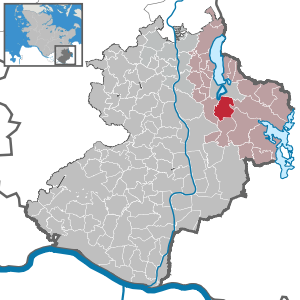
| Location of the community Schmilau in the Duchy of Lauenburg | ||
  |
||

Schmilau is a municipality in the Duchy of Lauenburg in Schleswig-Holstein . Farchau is located in the municipality.
history
With the battle of Schmilau in 1093 Schmilau was first mentioned as Smilov . With the support of Billunger Magnus , Heinrich became ruler of the Abodrites . The name Smilov is of Wendish origin. The Schmilau Church was started in 1210 and completed by 1230 at the latest. During the Reformation it lost part of its independence as a parish in favor of St. George on the Mountain and became a chapel congregation .
A castle was built on the Marienhöhe in Farchau by the Ratzeburg bishop Evermod around 1160, of which walls and remains of moats are still preserved in nature. The bishop's castle briefly passed into the possession of the dukes of Saxony-Lauenburg around 1250 , but then fell back into the possession of the bishops of Ratzeburg. It was torn from the mandrel in the middle of the 14th century by Bishop Volrad . Excavations took place here in connection with the 800th anniversary of the Ratzeburg Cathedral . instead of. The Farchauer Mühle is located below this former castle square. From 1664 to 1848 there was a paper mill here . The Farchau hydropower plant was put into operation in 1925 at the confluence of the Schaalsee Canal and the Küchensee . In the same year the Lauenburgische Schaalseeschifffahrt was officially opened.
From September 1, 1896 to 1994, Schmilau had a train station on the Kaiserbahn , which is still used today for the Ratzeburg adventure railway for trolley rides.
politics
Community representation
Of the nine seats in the municipal council, the WGS community of voters has five seats since the 2018 local elections and the ABS (community of voters) four.
coat of arms
Blazon : "Divided by green and blue by a slanting silver wave bar, above a golden font, below an eight-spoke, sixteen-blade, golden water wheel ."
Attractions
- Schmilauer Chapel
- Schmilau adventure station ; Draisine rides on the disused Kaiserbahn.
- the former grain water mill from the 16th century - since 1820 gastronomy - "Farchauer Mühle", in the district of Farchau am Küchensee
Web links
Individual evidence
- ↑ North Statistics Office - Population of the municipalities in Schleswig-Holstein 4th quarter 2019 (XLSX file) (update based on the 2011 census) ( help on this ).
- ↑ Schleswig-Holstein topography. Vol. 8: Pölitz - Schönbek . 1st edition Flying-Kiwi-Verl. Junge, Flensburg 2007, ISBN 978-3-926055-89-7 , pp. 346 ( dnb.de [accessed July 24, 2020]).
- ^ Arthur Dähn: Ring walls and tower mounds - Medieval castles in Schleswig-Holstein , Husum 2001
- ↑ Werner Neugebauer : Schöne Holstein , Lübeck 1957, p. 419
- ↑ Guido Weinberger: The paper mills in the greater Lübeck area ... , Part 1. - In: Lübeck contributions to family history and heraldry , issue 62 May 2012, p. 29
- ↑ Schleswig-Holstein's municipal coat of arms
Albsfelde | Alt-Mölln | Aumühle | Bäk | Blue | Basedow | Basthorst | Behlendorf | Berkenthin | Besenthal | Bliestorf | Exchanges | Borstorf | Breitenfelde | Bröthen | Brunsmark | Brunstorf | Books | Buchholz | Buchhorst | Dahmker | Dalldorf | Dassendorf | Düchelsdorf | Duvensee | Single house | Elmenhorst | Escheburg | Fitzen | Fredeburg | Fuhlenhagen | Geesthacht | Giesensdorf | Göldenitz | Goddess | Grabau | Grambek | Grinau | Big floor | Great Disnack | Groß Grönau | Great Pampau | Great Sarau | Groß Schenkenberg | Grove | Gudow | Gülzow | Bream | Hamfelde | Hamwarde | Harmsdorf | Havekost | Hohenhorn | Hollenbek | Hornbek | Horst | Juliusburg | Kankelau | Kasseburg | Kastorf | Kittlitz | Klein Pampau | Klein reveler | Plumbing | Klinkrade | Koberg | Kollow | Koethel | Kröppelshagen-Fahrendorf | Krukow | Curved mass | Krüzen | Kuddewörde | Killing | Kulpin | Labenz | Langenlehsten | Lankau | Lance | Lauenburg / Elbe | Clay wheel | Linau | Lüchow | Lütau | Mechow | Möhnsen | Mölln | Mill wheel | Must | Mustin | Niendorf ad St. | Niendorf near Berkenthin | Nuts | Panting | Pogeez | Poggensee | Ratzeburg | Ritzerau | Römnitz | Rondeshagen | Roseburg | Sahms | Salem | Sandesneben | Schiphorst | Schmilau | Schnakenbek | Schoenberg | Schretstaken | Schulendorf | Poking soles | Schwarzenbek | Seedorf | Seven trees | Seven oaks | Sierksrade | Sirksfelde | Steinhorst | Sterley | Stump | Talkau | Tramm | Walksfelde | Wangelau | Wentorf (Amt Sandesneben) | Wentorf near Hamburg | Wiershop | Witzeeze | Wohltorf | Woltersdorf | Worth | Ziethen
Community-free area in the Duchy of Lauenburg
Sachsenwald district