Skogafoss
| Skogafoss | ||
|---|---|---|
|
The Skógafoss |
||
| Coordinates | 63 ° 31 '55.56 " N , 19 ° 30' 40.68" W | |
|
|
||
| place | Skógar , Iceland | |
| height | 60 m | |
| width | 25 m | |
| flow | Skógá → Atlantic Ocean | |
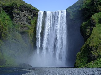
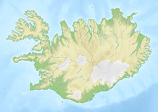
The Skógafoss [ 'skouːaˌfɔsː ] (Forest Waterfall) is a waterfall of the Skógá River in southern Iceland . It is located near Skógar in the municipality of Rangárþing eystra below the Eyjafjallajökull on a former steep coast.
After the coastline had shifted to the south, there was a steep drop from the Icelandic highlands towards the sea over hundreds of kilometers .
At such a point, the Skógafoss pours 60 meters down over a width of 25 meters.
On the eastern side of the waterfall, a famous trekking path, the Laugavegur , leads up to the Fimmvörðuháls pass and on over the Þórsmörk to Landmannalaugar .
A legend tells that the first Viking settler in this area, Þrasi Þórólfsson, buried a treasure in a cave behind the Skógafoss. Years later, an Icelandic boy spotted the chest but could only grab the handle before the box disappeared. The ring of the treasure chest is now kept in the Skógasafn Museum .


