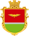
Sokoliwske
| Sokoliwske | ||
| Соколівське | ||

|
|
|
| Basic data | ||
|---|---|---|
| Oblast : | Kirovohrad Oblast | |
| Rajon : | Kropyvnytskyi district | |
| Height : | 144 m | |
| Area : | Information is missing | |
| Residents : | 2,490 (2001) | |
| Postcodes : | 27641 | |
| Area code : | +380 522 | |
| Geographic location : | 48 ° 29 ' N , 32 ° 12' E | |
| KOATUU : | 3522587201 | |
| Administrative structure : | 14 villages | |
| Address: | вул. Шевченка буд. 23 27641 с. Соколівське |
|
| Website : | Rural community website | |
| Statistical information | ||
|
|
||
Sokoliwske ( Ukrainian Соколівське ; Russian Соколовское Sokolowskoje ) is a village in the Ukrainian Oblast of Kirowohrad with about 2500 inhabitants (2001).
Sokoliwske is the administrative center of the land Municipality in Rayon Kropywnyzkyj with a total of 6500 inhabitants that even the villages Lypowe ( Липове , ⊙ ) with about 30 residents, Nova Pavlivka ( Нова Павлівка , ⊙ ) with about 330 inhabitants, Nowopetriwka ( Новопетрівка , ⊙ ) with about 130 inhabitants and Tschernjachiwka ( Черняхівка , ⊙ ) with about 680 inhabitants and villages Wyschnjakiwka ( Вишняківка ) Iwaniwka ( Іванівка ) Beswodnja ( Безводня ) Karlivka ( Карлівка ) Hannynske ( Ганнинське ) Darjiwka ( Дар'ївка ) , Nasariwka ( Назарівка ) and Oleniwka ( Оленівка ) belong.
The village lies on the banks of the Suhokleja ( Сугоклея ), a right tributary of the Inhul , 8 km southwest of the center of Rajon- and Oblasthauptstadt Kropywnyzkyj .
Web links
- Website of the municipal council on rada.info. (Ukrainian)
Individual evidence
- ↑ Local website on the official website of the Verkhovna Rada ; accessed on December 26, 2017 (Ukrainian)
- ^ Website of the rural community ; accessed on December 26, 2017 (Ukrainian)

