Soppensee
| Soppensee | ||
|---|---|---|

|
||
| Geographical location | Canton lucerne | |
| Drain | Seebach | |
| Places on the shore | Soppensee (municipality of Buttisholz ) Seehof (municipality of Menznau ) Buholz (municipality of Ruswil ) |
|
| Data | ||
| Coordinates | 648761 / 215 674 | |
|
|
||
| Altitude above sea level | 596 m above sea level M. | |
| surface | 22.7 ha | |
| length | 800 m | |
| width | 400 m | |
| scope | 2.075 km | |
| Maximum depth | 28 m | |
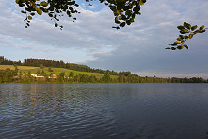
The Soppensee or Soppisee is a lake in the Swiss Lucerne Rottal ( canton Lucerne ). There is a settlement of the same name on its east bank.
location
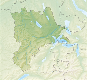
The lake is on the territory of the municipality of Buttisholz ; the bank zone in the west and south-east forms the municipal boundary to Menznau and Ruswil. The water area has an extension of 0.227 km². The surface level is 596 m above sea level. M. The Soppensee m has a maximum length of 800 in NW / SE direction transverse to m, a maximum width of the 400th The maximum depth of the lake is 28 m.
It has no noteworthy above-ground inflow. Its outflow is the Seebach, which drains into the Wigger via the Rot .
Emergence
The Soppensee was created after the last Ice Age when the glaciers retreated from the Swiss Plateau around 15,000 years ago. The lake owes its name to the swampy bristle grass (Nardus stricta), which is called Burst, Nätsch or Soppa depending on the area .
use
The lake property has been privately owned by the Pfyffer-Feer family for centuries. This also includes 75 arenas on the shore area. The bank immediately drops off steeply and it is surrounded by a thick coat of trees and bushes. The area is under nature protection. Bathing is prohibited. The crabs from the Soppensee are considered a delicacy. The lake is leased to the Soppensee fishing company.
Web links
- Lakes in Switzerland: natural and storage lakes, Federal Office for the Environment FOEN, 2007 ( Memento of October 5, 2008 in the Internet Archive )
Individual evidence
- ↑ a b c Lakes (Federal Office for the Environment FOEN). Retrieved January 19, 2020 .
- ↑ Swisstopo National Map 234T, 2004 edition.
- ↑ According to the official cantonal and federal maps, cf. map.geo.admin.ch , accessed on September 26, 2019.
